 TIJUCA MASSIF, ITS FORESTS, AND THE SOCIAL METABOLISM OF THE CITY OF RIO DE JANEIRO, BRAZIL, FROM THE NINETEENTH TO THE EARLY TWENTIETH CENTURY
Abstract
The landscape of Rio de Janeiro, characterized by its unique geomorphology and the diversity of its forests and ecosystems, illustrates the historical processes that shaped the city’s formation. This study aims to explore the role of the Tijuca Massif, particularly the Tijuca Forest, in the urban expansion of Rio de Janeiro in the nineteenth and twentieth centuries, identifying the key factors that influenced land use and transformation within the nature-society-city dynamic that continues to resonate today. The insights in this article are based on a qualitative approach, which includes the analysis of specialized literature and documentary research conducted in historical archives. This massif and its green areas functioned as structuring vectors, influencing both the city’s territorial expansion and the formation of cultural practices and ways of life that define Rio’s identity. The presence of green spaces in the heart of the city goes beyond just being a natural heritage; it also highlights important cultural and historical aspects that redefine their significance. This understanding positions the city as a dynamic organism, constantly interacting with its biophysical environment. Urban transformations reflect a complex web of social, ecological, and political interactions, with the surrounding massif and its forests playing a vital role in this ongoing process.
Keywords:
Society-Nature Interactions; Urban Metabolism; Urban Forests; Historical Geography; Environmental History.
Resumo
A paisagem do Rio de Janeiro, marcada por seu singular arranjo geomorfológico e pela diversidade de suas florestas e ecossistemas, reflete o processo histórico de conformação da cidade. Este trabalho objetiva refletir sobre o papel do Maciço da Tijuca e, principalmente, da Floresta da Tijuca, no processo de expansão urbana do Rio de Janeiro nos séculos XIX/XX, identificando os principais fatores que orientaram o uso e a transformação do solo em uma dinâmica natureza-sociedade-cidade que reverbera até hoje. As reflexões deste artigo decorrem de uma abordagem qualitativa, baseada na análise da literatura especializada e em pesquisa documental realizada em arquivos históricos. Este maciço e suas áreas verdes atuaram como vetores estruturantes da cidade, influenciando tanto sua expansão territorial, quanto a formação de práticas culturais e modos de vida que compõem a identidade carioca. A presença de áreas verdes no coração da metrópole transcende o valor do patrimônio natural, revelando dimensões não só biológicas, mas também culturais e históricas que redimensionam sua importância. Assim, a cidade pode ser compreendida como um organismo dinâmico, em constante interação com o ambiente biofísico, no qual as transformações urbanas expressam uma rede de interações sociais, ecológicas e políticas, onde o maciço e suas florestas assumem centralidade como expressão deste metabolismo.
Palavras-chave:
Interações Sociedade-Natureza; Metabolismo Urbano; Florestas Urbanas; Geografia Histórica; História Ambiental.
Resumen
El paisaje de Río de Janeiro, caracterizado por su singular configuración geomorfológica y por la diversidad de sus bosques y ecosistemas, refleja el proceso histórico de conformación de la ciudad. Este trabajo tiene como objetivo examinar el papel del Macizo de Tijuca - y, en particular, del Bosque de Tijuca - en la expansión urbana de Río de Janeiro durante los siglos XIX y XX, identificando los principales factores que orientaron el uso y la transformación del suelo en una dinámica naturaleza-sociedad-ciudad que continúa resonando hasta el presente. El análisis se basa en un enfoque cualitativo, sustentado en la revisión crítica de la literatura especializada y en la investigación documental realizada en archivos históricos. El Macizo de Tijuca y sus áreas verdes actuaron como vectores estructurantes de la ciudad, influyendo tanto en su expansión territorial como en la conformación de prácticas culturales y modos de vida que constituyen la identidad carioca. La presencia de áreas verdes en el corazón de la metrópoli trasciende el valor del patrimonio natural, revelando dimensiones no solo biológicas, sino también culturales e históricas, que redefinen su importancia. En este sentido, la ciudad puede comprenderse como un organismo dinámico, en constante interacción con el entorno biofísico, en el cual las transformaciones urbanas expresan una red de interacciones sociales, ecológicas y políticas, y en la que el macizo y sus bosques asumen un papel central como expresión de este metabolismo urbano.
Palabras-clave:
Interacciones Sociedad-Naturaleza; Metabolismo Urbano; Bosques Urbanos; Geografía Histórica; Historia Ambiental.
INTRODUCTION
Since its founding in 1565, establishing and expanding the city of Rio de Janeiro has required continuous efforts to appropriate, transform, distribute, consume, and excrete nature (TOLEDO & MOLINA, 2007). It was essential to intervene in various ways within a vibrant and heterogeneous natural environment, which sometimes evoked enchantment and other times insecurity, characterized by its multitude of native ecosystems: flooded and marshy areas, mangroves, and steep forested slopes, among others (BERNARDES, 1992). The initial settlement focused on the flat coastal areas, while the hills and forests served as significant geographical barriers, sometimes as limits and at other times as borders.
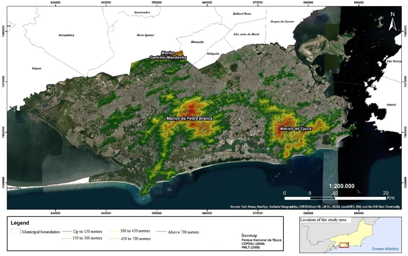
In this context, the relevance of the Serra da Carioca becomes evident, as it is one of the main mountain ranges of the Tijuca Massif. This range is in the southern portion of the massif, extending from the city’s central area to the southern zone (Figure 1). This mountain range is the source of the Carioca River, the primary watercourse supplying the city, which was established in the early nineteenth century. The geomorphology of Rio de Janeiro significantly influenced its urban development and expansion. The city’s growth was shaped by its coastal massifs, as Portuguese strategic priorities focused on the domination and defense of Guanabara Bay. This bay’s natural conditions were ideal for the establishment of forts and fortresses, which protected against frequent attacks from pirates and Indigenous groups during the sixteenth and seventeenth centuries (BERNARDES & SOARES, 1990; CAVALCANTI, 2004; SEDREZ, 2004; ABREU, 2013). The city was settled and protected by Guanabara Bay and the Tijuca Massif (MARENGA & SILVA, 2015), despite numerous adverse natural conditions that would have hindered its formation.
Map of the city of Rio de Janeiro, highlighting the mountainous areas that make up the Tijuca Massif and the Pedra Branca Massif.
It is important to note the significance of Serra da Tijuca during the colonial period, given its topographical features (Figure 1).
The hills in this region also provided a natural defense against invasions, as demonstrated by the French attempt to capture the city (CAVALCANTI, 2004). The area played a key role in providing natural resources, as it was exploited for the extraction of firewood and timber, which were used for city construction and other purposes. Additionally, its springs and watercourses, including the Maracanã and Comprido Rivers, were essential to the city’s water supply (ABREU, 2013; CAPILÉ, 2018). The topographical features that made Serra da Tijuca strategically important for the city’s fortification - its slopes and dense forests - also created challenges for urban expansion into the interior. This situation, which persisted throughout the sixteenth century, resulted in the initial population being concentrated around Guanabara Bay (ABREU, 2013).
Urban growth during the seventeenth and eighteenth centuries did not significantly change the characteristics that originally defined the city’s physiognomy. In contrast, the transformation of the urban landscape in the nineteenth century resulted from the annexation of not only new areas but also new functions, along with the development of neighborhoods and suburbs (BERNARDES & SOARES, 1990). Urban expansion required various significant alterations to the landscape, including draining swamps, dismantling hills, channeling and straightening rivers, constructing tunnels, and infilling large areas. These processes have significantly shaped Rio’s landscape over the centuries (ABREU, 2013; CAPILÉ, 2019). It is important to consider the arrival of the Royal Family and the Portuguese Court in 1808, which numbered around 12,000. This influx significantly accelerated transformations in the area by increasing the population and creating a greater demand for natural resources such as water, coal, firewood, and timber. This surge in demand placed considerable pressure, especially on the forests of the Tijuca Massif (CABRAL, 2011; ABREU, 2014).
In 1832, Charles Darwin described the landscape of Rio de Janeiro1, highlighting the city’s beauty and the grandeur of the Tijuca Massif. This mountain range spans 95 km2 and runs through the city’s central part from northwest to southeast (ABREU, 2014). The Tijuca Massif, covered by forests at various stages of succession, has significantly influenced the urban expansion of Rio de Janeiro since its founding, particularly during the nineteenth century. It played a crucial role in shaping both the territorial occupation and the socioeconomic dynamics of the city (FRIDMAN, 1999; ABREU, 2014).
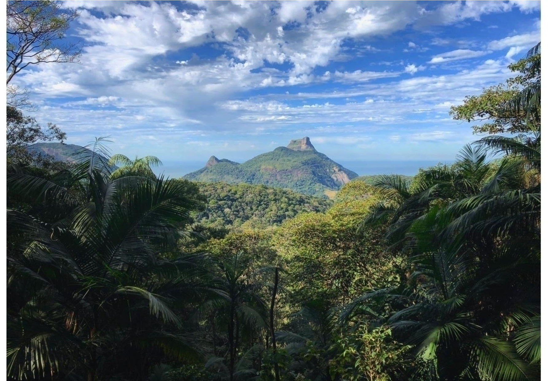
The Tijuca Forest, situated in the massif of the same name, is often regarded as an untouched forest or the result of a reforestation project aimed exclusively at addressing a water supply crisis (see Figure 2).
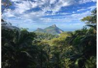
View of Pedra da Gávea, from the Vista do Almirante in the Tijuca Forest Sector of the Tijuca National Park, with emphasis on its green areas.
Another interpretation suggests that this project was carried out solely by Major Manoel Gomes Archer and six enslaved individuals in the latter half of the nineteenth century, and while this claim has some truth, it is only partially accurate. Such narratives oversimplify a rich and complex history that involves not only forest recovery but also the transformation of land use and the relationships between nature, society, and the city that result from this lengthy process (DRUMMOND, 1988; HEYNEMANN, 1995; SALES & GUEDES-BRUNI, 2023).
This reforestation initiative was primarily aimed at ensuring the city’s water supply. However, it also represented a shift in how nature, particularly forests, was perceived. Instead of being viewed solely as wilderness, forests are now seen as valuable resources that should be managed, conserved, and used strategically and rationally (SALES, 2021). The planting of trees recognized as “legally protected timber” involved careful selection based on specific attributes. This initiative was initially led by Major Archer and later by other administrators, with the assistance of enslaved people and workers who had practical knowledge of the forest. This process marked a significant milestone in the environmental history of Rio de Janeiro. It illustrates how various human interventions and intentions have transformed the landscape. When viewed from a historical perspective, these actions can take on contrasting meanings: at times, they contribute to destruction, while at other times, they foster restoration.
The Tijuca Massif and the Tijuca Forest have not only influenced the city’s physical expansion but also played a significant role in shaping its lifestyle and cultural identity. The presence of green spaces in the heart of the metropolis has fostered an appreciation for a more pastoral way of life, particularly among Rio de Janeiro’s elite. Instead of expanding towards the coast, they began seeking refuge on the forested slopes of the massif, unlike the trend in other coastal cities. The mild climate of the forested slopes, along with the development of tram lines and the expansion of the hotel network in the nineteenth century, contributed to this. This relationship between urbanization and nature is a central theme for understanding the history of Rio de Janeiro and its landscapes (ABREU, 2013). It remains a relevant topic in today’s context of urban expansion, which is often disorganized and faces challenges posed by the climate emergency.
The establishment of the Tijuca Forest, Paineiras Forest, Andaraí Grande Forest, and Jacarepaguá Forest - all recognized as national forests and situated in the Tijuca Massif - occurred during the latter half of the nineteenth century (SALES & GUEDES-BRUNI, 2024). By examining these forests and the massif itself within the context of the city of Rio de Janeiro, we aim to analyze their roles as significant markers in the city’s expansion during the nineteenth century. Additionally, we seek to identify the key vectors that influenced land use and transformation within this urban dynamic, which continues to resonate to the present day.
Consequently, the reflections in this article stem from a primarily qualitative approach, which is based on both a literature review of the topic and documentary research conducted in historical archives. The investigation relied on consulting both primary and secondary sources held by institutions such as the National Archives and the National Library, among other collections. The documents were carefully examined and integrated into the theoretical discussions presented throughout the text.
The objectives are as follows: (1) to examine the role of the Tijuca Massif, particularly the Tijuca Forest, in the urban expansion of Rio de Janeiro during the nineteenth century; (2) to identify the socioeconomic and environmental factors that influenced land use changes within the massif in the past; and (3) to explore how human interactions with the massif affected urban dynamics and the relationships between society and nature in the city during the nineteenth and early twentieth centuries, while also considering how these interactions were mutually influential.
THE RURAL AND THE URBAN IN THE FABRIC OF AN EXPANDING CITY
At the beginning of the nineteenth century, the administrative structure of Rio de Janeiro consisted of 11 parishes2 (SANTOS et al., 2013). These parishes could be classified as urban or rural based on their most prominent characteristics. However, this classification did not adhere to strict or standardized criteria; instead, it was influenced by a combination of administrative, demographic, and economic factors, among others. Urban parishes typically corresponded to areas within the city, whereas rural parishes were located outside the city’s defined perimeter. However, this distinction did not prevent rural parishes from being reclassified over time as their characteristics changed. Additionally, new administrative units could be established if deemed necessary by the relevant authorities (ABREU, 2013).
Abreu (2013) notes that in the late nineteenth century, the city’s parishes included thirteen that were classified as urban and eight rural. Among these, Campo Grande, Guaratiba, Jacarepaguá, and Santa Cruz, all located in the western part of Rio de Janeiro, were particularly noteworthy for their demographic growth. It seems that the western part of the city was still fundamentally a rural area (NORONHA-SANTOS, 1965; ABREU, 2013). At the start of the 20th century, this situation remained unchanged, as illustrated by the title of a work published by Armando Magalhães Corrêa, which focused on the west zone and referred to it as the Sertão Carioca (CORRÊA, 1936). If there were 11 parishes in Rio de Janeiro at the beginning of the nineteenth century, by the end of that century, this number had nearly doubled (ABREU, 2013).
When analyzing the spatial organization of the Parish of Jacarepaguá, which includes part of the forests of the Tijuca Massif, particularly focusing on the territorial division of this massif in the nineteenth century, it becomes evident that land-use changes were a reality. In the first half of the nineteenth century, landowners primarily utilized their land for coffee cultivation and actively sought to expand their territories by acquiring new areas (ABREU, 2014). It is important to note that the largest coffee plantations in Brazil during the early 1800s were situated in the Tijuca Massif. This is supported by the report of Louis François Lecesne, who arrived in Brazil with his family in 1816, along with another prominent coffee grower from that era, Charles Alexander von Mocke.:
“He came to Brazil with a grandiose plan of setting up a model farm for coffee cultivation here, which, unfortunately, at that time, was not accepted by D. João, who, however, a little later, would give greater support to coffee growers. He was not discouraged and set to work alone. He was the first to plant more than 50,000 coffee trees, soon followed by his neighbor Charles Alexander von Moke, with 40,000 coffee trees, as evidenced by the testimony of distinguished travelers, especially those of Spix and Martius, Langsdorff and Hippolyte Taunay, as he was also the first to help and instruct those who sought him to learn about the most advanced methods of doing so” (FERREZ, 1972, p. 32).
The borders3 were often not clearly defined, so natural features such as hills and rivers served as spatial delimiters. When maps were available, they played a crucial role in the territorial planning of both the massif and the city (SALES, 2021). In this context, locations such as “Cascata Grande”, “Gávea”, “Gávea da Tijuca”, “Itanhangá”, and primarily “Tijuca” were areas that historically designated the “Tijuca Forest” and/or were adjacent to it. Furthermore, it is essential to recognize the potential interactions among the inhabitants that could arise from social tensions related to productive activities and the use of forest and water resources. The Almanak Laemmert reports that in 1851, at least 20 farmers were in the area known as “Tijuca”4. Among these, three families played a significant role in the local coffee economy: Guilherme Midosi, Luiz Guilherme Lecesne, and the widow Isabel Mok.
Recognizing toponyms (place names) and anthroponyms (names of former owners and properties) enables us to partially reveal the spatial arrangement and territorial dynamics of the area known as “Floresta da Tijuca” and its surroundings. In 1855, ten landowners in the area known as “Tijuca” sold their properties to facilitate the establishment of plantations. This acquisition was noted by Couto Ferraz, a significant figure in the high governance of the Second Reign (BRASIL, 1855; BEDIAGA, 2017). In relation to the lands designated as “Paineiras”, particularly the area where the “Floresta das Paineiras” was planted (see Figure 3), the property owned by Agostinho José Ignacio da Costa Figueiredo and the heirs of Silvestre Pires Chaves (BRASIL, 1855) is of particular significance. Using this data, we can approximate the locations of some land acquired by the Imperial Government, particularly in the 1850s. This land was designated for the planting of legally protected timber from national forests, which led to a reconfiguration of the local cartography.
In its 1860 publication, Almanak Laemmert not only listed the farmers and main farmers of each parish but also introduced a new term: “Coffee farmers”. In the section for the locality known as “Tijuca”, two notable individuals stood out: Luiz Guilherme Shesses (also recorded as “Lecesne”) and Miguel José Gomes da Rocha. Additionally, some farmers from this parish were included for the first time, as they had not been listed in previous years. By the end of the nineteenth century, the number of farmers and cultivators in the “Tijuca” locality had declined significantly. Only a few remained: Antônio Serpa Pinto Junior as a farmer, the “Widow of Miguel José Gomes da Rocha” as a coffee farmer, and Joaquim Firmino de Menezes Campos as a cultivator5.
In the second half of the 1800s, farms and coffee plantations were common in the Tijuca Massif, even as the planting of the Tijuca Forest began in 1862 and continued for over thirty years. During this period, efforts were made to establish additional national forests. New forests were being planted in degraded areas, while others were naturally regenerating due to forest dynamics. However, other areas continued to be used for coffee cultivation. This situation highlights the concept of multiple simultaneous land uses and reflects the potential conflicts that arose in the Tijuca Massif during the nineteenth and early twentieth centuries.
During the expropriation process, a noticeable and asynchronous change occurred in the functionality of the lands in the massif. The productive coffee-farming areas were replaced not only by the planting zones intended for a large reforestation project - initially led by Major Archer in the case of the Tijuca Forest - but also by regions of natural regeneration. The various regenerating phytophysiognomies revealed distinct phases of the forest succession process, a natural part of forest dynamics. However, human agency also played a significant role in this natural regeneration process, often in subtle ways. This influence can be seen in several factors: the management techniques used in agriculture, the size of the forest areas that were preserved from logging on each property, the occasional sparing of specific tree species for cultural or practical reasons, the selection of slopes for farming, the duration of agricultural activities on the land, and the time spent negotiating land acquisitions during the Empire. In all these aspects, human actions - or inactions - were fundamental to the process (CABRAL, 2011; ABREU, 2014; SALES et al., 2024). From the lush and symmetrically ordered coffee fields emerged a frail forested landscape, hinting at a future that would restore both water and imagery. This area was celebrated by the earliest arrivals in the city, who found themselves surrounded by a dense, evergreen forest rich in flora and fauna, offering adventure. This forest served as a source of urban illumination.
The growth of urban space in Rio de Janeiro and its administrative organization during the 1800s, along with the territorial disputes that emerged in various parishes - especially in the Parish of Jacarepaguá - offer significant opportunities for discussion of environmental, historical, and geographical aspects. Additionally, the changes in property boundaries and land use in the Tijuca Massif further enrich these conversations. Notably, from 1850, there was a powerful desire in Imperial Brazil to move beyond its colonial past and align with the evolving paradigms of European nations. This shift led to significant urban changes, particularly in Rio de Janeiro, which had been recognized as the “head of Brazil” since the Portuguese Court relocated there (MATTOS, 2005).
Analyzing the Tijuca Massif, with its planted forests, regenerated green areas, and remnants of natural forest, allows us to appreciate its significance beyond mere natural heritage. This understanding helps us re-evaluate their cultural and historical importance. The emergence of the Tijuca Forest, a result of the reforestation project, has fostered greater integration between rural and urban parishes, which is a noteworthy development in itself.
The rural parishes played a key role in the reforestation project by providing forest resources, such as seedlings and seeds. These resources were sourced from the area surrounding the Pedra Branca Massif and from farms in the towns of Jacarepaguá and Guaratiba. Their contributions helped supply nurseries with seedlings and enriched the plantations. Such a systemic connection is illustrated in the report on the forestry services undertaken in Tijuca Forest in 1872. When discussing “seedlings”, Major Archer indicated that:
“(...) The employee specially tasked with acquiring seeds in the virgin forests of Guaratiba and surrounding areas, the richest and most abundant in this municipality, provided a large number of seeds of ariribú, angelim-rosa, bicuíba, canela-batalha, canela-limão, cedro-rosa, garaúna, guarajuba, goiabeira-cascuda, guaretá, guarapiapunha, jacarandá-tan, jequitibá and pau-brasil-branco (...)” (BRASIL, 1872).
A careful selection of species is evident, including several recognized as “hardwoods”, including bicuíba, cedro-rosa, garaúna, guarajuba, and pau-brasil-branco. These species are primarily cultivated to establish new planted forests. In addition to addressing the water supply crisis, these forests provide other benefits for people, such as thermal comfort. Furthermore, they serve as a repository of hardwoods for future use within a genuine silvicultural project (SALES et al., 2024).
Another notable aspect of the city’s ecosystem is the valuable contributions of the Tijuca Forest to public parks and gardens through seedling and seed exchanges. This practice is documented in correspondence between Francisco José de Freitas and Major Archer in 1870, where Freitas requested “100 baskets of hardwood seedlings from the nurseries” for transportation to the city (NATIONAL LIBRARY, 2012). Additionally, in 1873, it was noted that seedlings and seeds from trees found in the Tijuca Forest, as requested “by Dr. Glaziou, should be provided for the landscaping of the Campo da Aclamação6(...)” (NATIONAL LIBRARY, 2012). These texts illustrate the exchange and flow of materials and knowledge between the forests of the Tijuca and Pedra Branca Massifs, as well as between these forests and other areas of the city of Rio de Janeiro. The intense, diverse metabolism of interactions between rural and urban areas reshaped the new urban face of the Imperial Court.
The paths in the Tijuca Massif that connected urban areas to coffee farms and rural parishes were frequently used in the first half of the 1800s. These routes were also traversed by naturalists and travelers, including Maria Graham, who arrived in Brazil in 1821. During her journey to Fazenda Santa Cruz, a former property of the Jesuit priests, she conducted botanical collections that contributed to Martius's work, Flora Brasiliensis, and illustrated various landscapes of the massif. In 1823, she described her visit to Fazenda Santa Cruz in her diary:
“(...) Today I saw passion fruit flowers of colors I had never seen before: green, pink, scarlet, blue; wild pineapples of beautiful crimson and purple; wild tea, even more beautiful than the elegant Chinese bush; marsh palms and countless aquatic plants new to me (...)” (PEIXOTO & FILGUEIRAS 2008, p. 995).
The rural areas, which had primarily provided agricultural and livestock products to urban parishes - especially those influenced by the Court - now sourced their supplies from local vegetation. In addition to the spatial location of productive activities, a gradual process of urban reconfiguration is evident. This process reflects the influence of rurality in creating a new city model that not only emulates the idyllic characteristics that shape social imagination but also resembles the ideals of European parks and gardens. This transformation allows inhabitants to experience their own scenic beauty as if they were tourists traveling on steamships of the time.
This movement can be understood, in analytical terms and avoiding anachronistic interpretations, as an embryonic form of exurbanization. Formally, rural areas began to serve symbolic, recreational, and environmental functions connected to urban dynamics, even though they were not fully urbanized. It is important to highlight the proposal put forth by Rua et al. (2021). They suggest that, through a relational and procedural understanding of space, urban and rural areas should be viewed as interdependent aspects of the same socio-spatial dynamic. In this framework, urbanity is perceived as a diffuse phenomenon that transcends various territories. In summary, urban areas in rural settings understand space as a multiscale and multidimensional totality, where urban and rural aspects intertwine in an asymmetrical, dynamic, and hybrid manner, contributing to the production of contemporary spatialities (RUA et al., 2021).
In the nineteenth century, the modern concept of urban design increasingly included gardens and parks in European cities. This shift promoted a rapprochement with the environment and established new forms of interaction between civilization and nature. Additionally, it sparked a renewed fascination with forests (DUARTE, 2005). Throughout the nineteenth century, interactions between humans and the biophysical environment underwent a significant transformation. This change sparked growing interest in the plant world, driven by scientific advancements spreading across the West. As a result, there was an increased appreciation for the natural world (SALES et al., 2024). Despite the romanticized view that often portrays the countryside as a pure and harmonious place, while depicting the city as harmful, the reality is quite different. There is continuous interdependence between these two spaces, both culturally and politically. This dynamic relationship significantly influences the way of life of the people who inhabit them (SANTOS, 2004; WILLIAMS, 2011). What would this countryside be, if not the rural, or even the sertão of Magalhães Corrêa? From the perspective of Antônio Carlos Robert Moraes, the sertão can be understood as a place that defines itself in relation to its opposite, the non-sertão (MORAES, 2003). This means that the characteristics of the sertão are identified by contrast to the qualities that the non-sertão possesses, highlighting the positivity that is perceived to be absent in the sertão itself.
In Europe, the advancement of communication and transportation technologies has driven rural-to-urban migration. This means that urban traits - such as the consumption of industrial goods, the use of agricultural machinery, and access to financial services - are becoming more common in rural areas (WILLIAMS, 2011). This process does not simply involve extending the city into the countryside; rather, it entails reorganizing rural spaces according to the logic of capitalism. In Rio de Janeiro, the mountain massif that previously served as a dividing line between these antagonistic, yet interconnected areas not only facilitated increased interactions between them but was also overcome in its role as a barrier with the introduction of the road system implemented in the city between the late nineteenth century and the early twentieth century.
The concept of restoring a forest damaged by coffee cultivation taps into genuine, nostalgic ideals of recreating a supposedly unspoiled environment. This notion reflects the myth of a rural “golden past” (WILLIAMS, 2011). However, while the replanted forest is often perceived as restored nature, it is, in reality, a constructed space shaped by urban assumptions and government interests.
A TROPICAL PUBLIC PARK WITH EUROPEAN AIRS IN THE HEART OF THE CITY
During the Second Empire (1840-1889), the production of urban space in Rio de Janeiro underwent notable transformations. These changes were driven by population growth, infrastructure modernization, and the consolidation of the city as Brazil's political and economic hub (ABREU, 2013). The elevation of the city to the status of the Capital of the Empire of Brazil accelerated the expansion of the urban area, which had previously been confined by the hills of Castelo, São Bento, Santo Antônio, and Conceição in its central region. The city began to expand into areas such as Tijuca, Andaraí, and Gávea, where parts of the population settled. This expansion brought improvements, including the development of roads and horse-drawn tram lines. As a result, a stratified spatial structure emerged, leading to the establishment of residential neighborhoods for the elite, while lower-income classes were pushed to the peripheral areas (FRIDMAN, 1999; SANTOS, 2011; ABREU, 2013).
At the beginning of the nineteenth century, the development of parks and gardens in European cities, as previously mentioned, aligned with the emerging modern urban concept (DUARTE, 2005). This trend also reflected the romantic appreciation of nature and influenced landscaping efforts to beautify the city, particularly through Glaziou’s creativity (BRITO, 2015).
The transformation of the reforestation area in the Tijuca Massif into an “urban park” in the city’s heart included the creation of special points of interest for visitors. This project was entrusted to artists, reflecting the desires of an imperial elite. It fed into the Western imagination while promoting a new way of conceptualizing and experiencing public spaces (SALES et al., 2024). The native flora played a significant role in reshaping the natural landscape. It is rich in diverse habitats, forms, and species, demonstrating vigorous, resilient natural vegetation regeneration. Many plant species intermingled with the orderly, delicate designs typical of European parks, enhancing the greenery of tropical urban areas, despite modern aspirations to mimic European styles.
Dom Pedro II played a significant role in modernizing and improving Rio de Janeiro, leading to an influx of residents from various parts of Brazil and abroad. This transformation attracted many foreigners who chose to settle in the city (SALES et al., 2024). The first guide to Rio de Janeiro, designed to identify the city's most notable businesses and establishments clearly, was published in 1873 (PERROTTA, 2015, p. 68).
This same year, the initial book on Rio de Janeiro, titled “Guide for Foreigners in Rio de Janeiro and Historical News about the Main Monuments”, was also released (PERROTTA, 2015). The advertisements in newspapers and commercial pamphlets promoting tourist tours referred to the landscapes of the Tijuca Massif with expressions such as “Fluminense Eden”, “Picturesque Tours”, and “Restorative Picnics”, among others (PERROTTA, 2015; SALES et al., 2024).
At the beginning of the twentieth century, the modernization of Rio de Janeiro followed the European model, particularly during the administration of Pereira Passos, who served as mayor from 1903 to 1906. This transformation was designed to serve the interests of both the Federal Government and the municipality. The urban reform initiative, led by the Federal Government in Rio de Janeiro, was centered around the ideal of progress, defined as material development. It had two primary objectives: first, to modernize the port of Rio de Janeiro to increase its import capacity, and second, to cultivate an image of a civilized city capable of attracting immigrants as labor, which was in short supply in São Paulo's coffee industry (AZEVEDO, 2015). This vision aligns with the understanding - emerging from the internationalization of the economy in the late nineteenth century - that a city is essentially a product (CHIAVARI, 1985).
Under the leadership of Pereira Passos, Rio de Janeiro underwent urban restructuring focused on expanding and reorganizing the road system. This municipal vision, based on an organicist ideal7, regarded the city as a living body in which all its parts should work together to ensure the harmonious functioning of urban space. The intervention aimed not only to improve physical infrastructure but also to transform the population's habits, striving to instill a model of civility influenced by European, bourgeois, and hygienic values. The road system implemented connected the entire central area of the city to the northern suburbs, establishing road links between various neighborhoods. Specifically, roads were designed to connect the neighborhoods of Tijuca, Jacarepaguá, and Barra da Tijuca, as well as Gávea and Barra da Tijuca, among others (AZEVEDO, 2015).
This process demonstrates the forest's intrinsic importance to the city's functioning. It plays a crucial role in protecting rivers like the Maracanã and Carioca, contributes to climate well-being, and subsequently improves public health. Additionally, the forest helps integrate distinct parts of the city through the modernized road system. The forest established in the nineteenth century was further developed in the twentieth century, becoming part of the initiative to value public spaces and enhance the integration of nature within the urban environment.
During that period, the significant urban and road transformations, particularly concerning the connections between the western, southern, and northern zones and the central area, facilitated greater spatial mobility. This highlights the influence and ongoing role that the massif plays in the city's development and dynamics (ABREU, 2013; ABREU, 2014).
CONCLUSION
The Tijuca Massif is not just a geographical landmark; it showcases the outstanding scenic beauty of its geomorphology and valuable biodiversity, serving as a historical vector for the transformation of Rio de Janeiro’s landscape. By constantly transforming, it can sometimes establish itself as a boundary, where its landforms and forest structure impose limitations on how it can be used. At other times, it serves as a frontier, enhancing urban metabolism while supplying the city’s needs with its natural resources.
Over the years, this massif and its forests have also undergone a resignification, symbolizing a glamorous icon for the people of Brazil. This is well expressed by the sobriquet “Éden Fluminense” that was given to it in the latter half of the nineteenth century, under which the domesticated and accessible rich national treasure was vaunted and, moreover, reflected its authentic nature and praised the unique Brazilian nation. This resignification resonates in the present day, as it is acknowledged globally as a cultural heritage. Such recognition reflects the impact of various anthropic interventions carried out in the Tijuca Massif, regardless of whether they have harmed its original vegetation over time. Additionally, it highlights the influence of natural morphologies and dynamics that have been socially incorporated into Rio de Janeiro's identity. The allure of this landscape captivates visitors and tourists, fostering a deep appreciation for the sense of place. This bond often ignites affection and a subsequent identification with the local culture.
The planting of Tijuca Forest and other national forests in the nineteenth century was driven by water scarcity and a changing perception of nature. This initiative also reflects a process of adapting the city to the strengths and limitations of its biophysical environment. Although the reforestation model implemented in Tijuca was successful in increasing tree cover and restoring water resources, especially in the nineteenth century, the area's biodiversity has not yet been adequately recovered. It is essential to undertake actions that enrich the flora and reintroduce fauna to restore the forest's natural synergy. This will help prevent it from becoming an "empty" forest, enhance its genetic diversity, and ensure its sustainability for many more centuries.
Over the decades, the urban expansion of Rio de Janeiro has resulted in significant transformations to the landscape. These changes include draining swamps, removing hills, altering and straightening rivers, creating tunnels, and leveling large areas. Together, these actions have led to successive transformations of the urban space. These processes were further complicated by efforts to develop human infrastructures, such as road corridors and new transportation methods. Additionally, factors such as the pursuit of financial profitability, which is reflected in land valuation and socio-spatial segregation, played a significant role. Furthermore, social dynamics influenced the city's overall layout.
The metabolism described here is part of a pluriverse discussion regarding the desired model for cities, especially in light of numerous contemporary challenges, including the urgent need to address the climate emergency, mitigate environmental risks, and create cities that are more socially and environmentally just. When exploring the role of the Tijuca Massif and its forests in the ever-changing dynamics of a city, it is important to consider how power structures influence actions. This reflection can help us understand the complex socio-environmental relationships that shape the urban environmental history of a city like Rio de Janeiro.
ACKNOWLEDGEMENTS
The authors would like to express their gratitude to Prof. João Rua and Dr. Begonha Bediaga for their valuable notes, discussions, and suggestions regarding this article. They also extend their thanks to Prof. Rafael Nunes for his assistance with the map. This study was funded by the Coordination for the Improvement of Higher Education Personnel - Brazil (Capes) under Financing Code 001, which was awarded to the first author.
NOTES
1
2
3
4
5
6
7
DATA AVAILABILITY
Not applicable.
REFERENCES
- ABREU, M. A. A cidade, a montanha e a floresta. In: FRIDMAN, F.; HAESBAERT, R. (Orgs.) Escritos sobre espaço e história. Rio de Janeiro: Garamond, 2014, p. 299-357.
- ABREU, M. A. Evolução urbana do Rio de Janeiro. Rio de Janeiro: Instituto Municipal de Urbanismo Pereira Passos, 2013.
- ALMANAK ADMINISTRATIVO, MERCANTIL E INDUSTRIAL DO RIO DE JANEIRO [Almanak Laemmert]. Rio de Janeiro: [s.n.], 1844-1899. Disponível em: . Acesso em: 2016-2021.
- AZEVEDO, A. N. A reforma de Pereira Passos: uma tentativa de integração conservadora. Tempos Históricos v. 19, n. 2, p. 151-183, 2015.
- BEDIAGA, B. Discreto personagem do império brasileiro: Luís Pedreira do Couto Ferraz, visconde do Bom Retiro (1818-1886). Topoi, v. 18, n. 35, p. 381-405, 2017.
- BERNARDES, L. M. C. Evolução da paisagem urbana do Rio de Janeiro até o início do século XX. In: ABREU, M. A. (Org.) Natureza e Sociedade no Rio de Janeiro. Rio de Janeiro: Secretaria Municipal de Cultura, Turismo e Esportes, 1992, p. 37-53.
- BERNARDES, L. M. C.; SOARES, M. T S. Rio de Janeiro: Cidade e Região. Rio de Janeiro: Secretaria Municipal de Cultura - Departamento Geral de Documentação e Informação Cultural, 1990.
- BIBLIOTECA NACIONAL. Fundo Administração da Floresta da Tijuca (TA) - Inventário dos Documentos Textuais . Rio de Janeiro: Biblioteca Nacional, 2012.
- BRASIL. Ministério da Agricultura, Comércio e Obras Públicas. Relatórios ministeriais. Rio de Janeiro: Imprensa Nacional, 1860-1900.
- BRASIL. Ministério do Império. Relatórios ministeriais. Rio de Janeiro: Imprensa Nacional, 1832-1888.
- BRITO, M. R. Práticas botânicas e experiências estéticas: as múltiplas faces de Auguste François Marie Glaziou no Brasil do século XIX. Tese, Universidade Federal do Rio de Janeiro, 2015.
- CABRAL, D. C. Águas passadas: sociedade e natureza no Rio de Janeiro oitocentista. RA’E GA - o espaço geográfico em análise, v. 23, p.159-190, 2011.
- CAPILÉ, B. Apagando a natureza: o desaparecimento dos ecossistemas alagados nos mapas urbanos do Rio de Janeiro. Terra Brasilis, v. 11, p. 1-27, 2019.
- CAPILÉ, B. Da lama ao Bairro, do Bairro à Lama: A Transformação da Socionatureza Urbana do Manguezal de São Diogo, Rio de Janeiro (1840-1870). Fronteiras: Journal of Social, Technological and Environment Science, v. 7, n 3, p. 21-42, 2018.
- CAVALCANTI, N. O. O Rio de Janeiro setecentista: a vida e a construção da cidade da invasão francesa até a chegada da Corte. Rio de Janeiro: Jorge Zahar, 2004.
- CHIAVARI, M. P. As transformações urbanas do século XIX. In: DEL BRENNA, G. R. O Rio de Janeiro de Pereira Passos: uma cidade em questão II. Rio de Janeiro: Index, 1985, p. 569-591.
- CORRÊA, A. M. O Sertão Carioca. Rio de Janeiro: Imprensa Nacional, 1936.
- DRUMMOND, J. A. O Jardim Dentro da Máquina: breve história ambiental da Floresta da Tijuca. Estudos Históricos, v. 1, n. 2, p. 276-298, 1988.
- DUARTE, L. F. D. La nature nationale: entre l’universalisme scientifique et la particularité symbolique des nations. Civilisations, v. 52, n 2, p. 21-44, 2005.
- FERREZ, G. Pioneiros da cultura do café na era da Independência. Rio de Janeiro: Instituto Histórico e Geográfico Brasileiro, 1972.
- FRIDMAN, F. Donos do Rio em Nome do Rei: uma história fundiária da cidade do Rio de Janeiro. Rio de Janeiro: Garamond, 1999.
- HEYNEMANN, C. B. Floresta da Tijuca: natureza e civilização no Rio de Janeiro - século XIX. Rio de Janeiro: Secretaria Municipal de Cultura, Departamento Geral de Documentação e Informação Cultural, Divisão de Editoração, 1995.
- KEYNES, R. D. Charles Darwin's Beagle diary. Cambridge: Cambridge University Press, 1988.
- LIMA, J. D. As fronteiras internas do Brasil. Espaço em Revista, v. 25, n. 2, p. 187-209, 2023.
- MARENGA, R. C.; SILVA, L. F. C. F. A influência das fortificações militares na expansão urbana da cidade do Rio de Janeiro sob a ótica da cartografia histórica. Revista Brasileira de Cartografia, v. 67, n 4, p. 851-866, 2015.
- MATTOS, I. R. Construtores e herdeiros: a trama dos interesses na construção da unidade política. Almanack Braziliense, n 1, p. 8-26, 2005.
- MORAES, A. C. R. O Sertão: um “outro” geográfico. Terra Brasilis v. 4, n 5, p. 1-9, 2003.
- NORONHA SANTOS, F. A. As freguesias do Rio Antigo. Rio de Janeiro: O Cruzeiro, 1965.
- PEIXOTO, A. L.; FILGUEIRAS, T. S. Maria Graham: anotações sobre a flora do Brasil. Acta Botanica Brasilica v. 22, n 4, p. 992-998. 2008.
- PERROTTA, I. Promenades do Rio: a turistificação da cidade pelos guias de viagem de 1873 a 1939. Rio de Janeiro: Hybris Design, 2015.
- RUA, J.; AGUEDA, B. C.; SIMONI, J. C. Urbanidade, Urbanidades no Rural e Multidimensionalidade do Espaço: Tecendo algumas Reflexões sobre as Relações Urbano-Rurais. Espaço Aberto, v. 11, n. 1, p. 153-170, 2021.
- SALES, G. P. S. A história contada a partir das árvores: um ensaio sobre o plantio da Floresta da Tijuca, no Rio de Janeiro, na segunda metade do século XIX. Tese, Pontifícia Universidade Católica do Rio de Janeiro, Rio de Janeiro, 2021.
- SALES, G. P. S.; BRITO, M. R.; GUEDES-BRUNI, R. R. Éden Fluminense”: de área de reflorestamento no maciço da Tijuca a espaço público europeizado do Rio de Janeiro na segunda metade do século XIX. História, Ciências, Saúde - Manguinhos, v. 31, p. 1-17, 2024.
- SALES, G. P. S.; GUEDES-BRUNI, R. R. Novas Fontes de Dados Biológicos que Apoiam a História Ambiental de uma Floresta Tropical do Sudeste do Brasil. HALAC - História Ambiental Latinoamericana e Caribenha, v. 13, n. 2, p. 281-308, 2023.
- SALES, G. P. S.; GUEDES-BRUNI, R. R. O Plantio das Primeiras Florestas Nacionais no Brasil: Política Florestal e o Surgimento da Silvicultura Tropical no Século XIX. Arcadia, n. 16, p. 1-8, 2024.
- SANTOS, K. S.; CARVALHO, R. C.; SARDELLA, A. B.; GRAÇA, A. J. S.; MENEZES, P. M. L. Evolução da paisagem da cidade do Rio de Janeiro, uma visão cartográfica: aspectos socioespaciais das freguesias a partir do século XX. In: V Simpósio Luso-Brasileiro de Cartografia Histórica, 2013.
- SANTOS, L. S. Os subúrbios do Rio de Janeiro no iní¬cio do século XX. Mneme - Revista de Humanidades, v. 12, n 30, p. 257-280, 2011.
- SANTOS, M. O espaço dividido: os dois circuitos da economia urbana dos países subdesenvolvidos. São Paulo: EdUSP, 2004.
- SEDREZ, L. F. The Bay of all beauties”: state environment in Guanabara Bay, Rio de Janeiro, Brazil, 1875-1975. Tese, Stanford University, 2004.
- SWYNGEDOUW, E. A cidade como um híbrido: natureza, sociedade e “urbanização-cyborg. In:, ACSELRAD, H. A duração das cidades: sustentabilidade e risco nas políticas urbanas. Rio de Janeiro: DP&A Editora, 2001.
- TOLEDO, V. M.; MOLINA, M. G. El metabolismo social: las relaciones entre la sociedad y la naturaleza. In: PEÑA, F. G.; MOLINA, M. G.; MORENO, J. L. S.; RUIZ, J. L. S. (Orgs.) El paradigma ecológico en las ciencias sociales. Granada: Editorial Universidad de Granada, 2007. p. 85-112.
- WILLIAMS, R. O campo e a cidade: na história e na literatura. São Paulo: Companhia das Letras, 2011.