
 Class-based residential segregation in Montevideo: a census data-based approach
The article examines class-based residential segregation in Montevideo and its metropolitan area using census data from 1996 and 2011. The population is classified according to a social class scheme that combines occupation type and occupational category. Overall segregation is measured using Moran’s I index, and LISA maps describe local patterns. Montevideo’s social classes exhibit distinct residential patterns that were already consolidated in 1996 and reaffirmed in 2011. The upper-middle class is concentrated along the southern coast and in the southeastern metropolitan area, while the working class is concentrated in peripheral areas and non-coastal metropolitan corridors. Between 1996 and 2011, working-class segregation increased, regardless of the spatial scale considered.
Keywords
residential segregation; social classes; Montevideo
 Thumbnail
 Thumbnail
 Thumbnail
 Thumbnail
 Source: own elaboration based on vector maps from the National Institute of Statistics (INE).
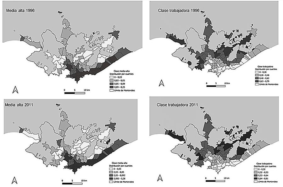 Source: own elaboration based on the 1996 and 2011 Censuses.
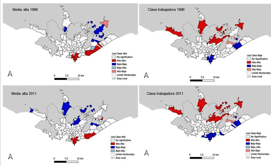 Source: Own elaboration based on the 1996 and 2011 Censuses.
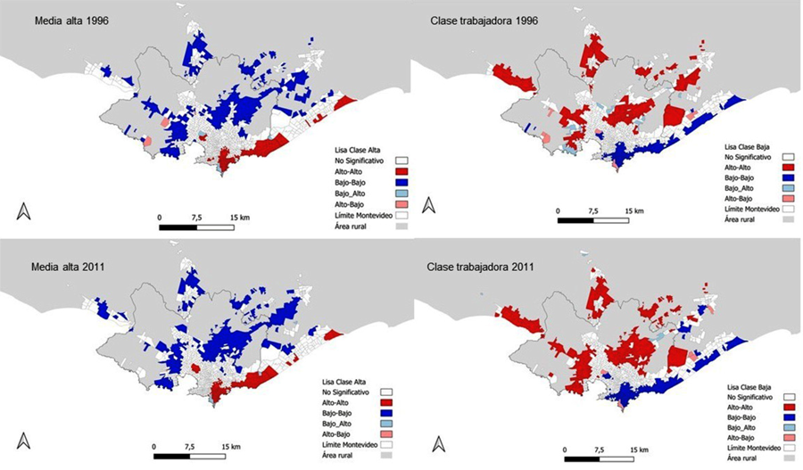 Source: Own elaboration based on the 1996 and 2011 Censuses.