
 Walking mobility: older adults and vulnerability to flooding
Abstract
This article investigates the overlap between older adults’ walking mobility and urban flooding in the municipality of São Paulo. The analysis uses data from the 2023 Origin and Destination Survey, filtered for walking trips made by individuals aged 60 and over, and combined with the Flooding Susceptibility Index (FSI) in a Geographic Information System environment (QGIS). The method allowed the identification of central zones, particularly Higienópolis and República, where 76.6% and 86% of older pedestrians’ walking trips occur in areas of high or very high susceptibility. The results reveal that older adult mobility is concentrated within territories vulnerable to flooding and highlight the need to integrate walkability planning, urban design, and climate adaptation to ensure safety, accessibility, and active aging.
Keywords:
older adult; walkability; floods; central areas; São Paulo
Resumo
Este artigo investiga a sobreposição entre mobilidade a pé de idosos e alagamentos urbanos no município de São Paulo. A análise utiliza dados da Pesquisa Origem e Destino 2023, filtrados para viagens a pé de pessoas com 60 anos ou mais, cruzados com o Índice de Suscetibilidade de Alagamentos (ISA) em ambiente de Sistema de Informação Geográfica (SIG). O método permitiu identificar zonas centrais, especialmente Higienópolis e República, onde 76,6% e 86% dos deslocamentos de pedestres idosos ocorrem em áreas de alta ou muito alta suscetibilidade. Os resultados revelam a concentração da mobilidade idosa em territórios vulneráveis a alagamento, apontando a necessidade de integrar planejamento de caminhabilidade, desenho urbano e adaptação climática para garantir segurança, acessibilidade e envelhecimento ativo.
Palavras-chave:
idoso; caminhabilidade; alagamentos; áreas centrais; São Paulo
Introduction
It is undeniable to acknowledge that large human crowds are facing several environmental crises, and it is therefore imperative that urban systems and their respective agendas adapt to climate change (Amorim-Maia and Olazabal, 2025). Global warming is a phenomenon caused by human activity (especially the emission of greenhouse gases) and has been impacting the climate severely, increasing the frequency, the intensity, the duration and the territorial range of extreme weather events such as heatwaves, severe storms, intense rain and flooding (IPCC, 2023). That is the reason why cities have become the center of attention for nations and public policies.
Over 30 years have passed since Rio-92/ECO-92, and countries still concentrate their strategies in mitigation measures (especially regarding emissions of greenhouse effect gases) instead of adaptation to climate change (Biesbroek et al., 2022). Several cities face an intricate and complex network of crisis that add up and result in urban changes that are almost irreversible and bring a sentiment of uncertainty (Panahi and Moayerian, 2025). This process has intensified and continues to intensify existing vulnerabilities and discrepancies, especially in developing countries (Veiga et al., 2024). For Oliveira and Bhuiyan (2024), the major reason for this fact is that developing countries were already dealing with their “old problems” (basic sanitation, infrastructure and urban mobility etc.) when they had to add the “current problems” (heatwaves, large volumes of rain and floods, etc.). However, at the same time this matter presents itself as a problem, it bears some potential to be worked on: new urbanization solutions – especially for cities in Latin America.
The Metropolitan Area of São Paulo (RMSP) is one of the major urban concentration areas in Latin America (Marengo et al., 2020; Valente and Laurini, 2022), with over 20 million inhabitants (IBGE, 2023). Given its urban, socioeconomic, industrial and environmental complexity, RMSP is an organism that combines a series of innovations along with deficiencies. Di Giulio et al. (2018) highlights that while there are institutional and financial powers that care about plans for climatic action, there are still high levels of CO2 concentration and other pollutants in the atmosphere, as well as high intensity of the urban phenomenon known as heat island and rain and floods.
It has become common to observe an increase in frequency of days with intense rain (over 50 mm of rain) in RMSP. Marengo et al. (2020) highlights that, over the last ten years, these days are occurring two to five times more each year. For Lima and Rueda (2018), one of the major aggravating factors for this problem were and still are the changes in the usage and occupation of the region’s soil, since there was a loss of green and permeable areas, as well as an increase in occupation of risk areas.
The inundations and floods in urban areas define themselves as one of the major hindrances to the resilience of contemporary cities, especially in tropical and subtropical metropolitan areas such as São Paulo. The frequency in which these episodes happen cannot be explained by rain intensity alone, because it results from the combination of multiple correlated factors, such as the environmental and topographic conditions, the presence (or absence) of adequate infrastructure, socio-spatial inequalities and the accumulated history of events in some areas (Marengo et al., 2020; Tucci, 2008).
Therefore, there is urgency for new frameworks, dynamic and fast enough to evaluate under what levels of vulnerability people are exposed to. At the same time, it is still uncertain under what degree societies can truly adapt to climate change, as well as where and when the adaptation was fulfilled (Juhola et al., 2024). When we talk about vulnerable people in urban spaces, it is indispensable to discuss their walkability. Being a pedestrian is the most direct form of contact any citizen can have with the city (Gehl, 2013). Walkability can be understood simply as the quality of being walkable (Sato, 2021) and, beyond that, relating with physical, environmental, socioeconomic and behavioral variables (Kronka Mülfarth et al., 2024).
Besides, matters of intersectionality1 and accessibility also become fundamental to be discussed in the scope of this work. Bearing in mind that the way citizens move around is fundamental to any urban core – since it results in social and economic benefits (Glaeser, 2016), this must be done in a democratic way. Despite of it, not everyone can move around equally (Albala, 2022; Carunchio, 2023; Sato, 2021), especially in a city such as São Paulo.
The elderly constitute a social group with high vulnerability within São Paulo. Whether due to climate reasons of thermal stress and heat discomfort (Alves, Duarte e Gonçalves, 2016) or due to reasons of ergonomic urban (im)mobility (Carunchio, 2023), this social group needs more attention, bearing in mind the aging process of Brazilian population (China et al., 2021), especially in the city of São Paulo. Data from the 2022 Population Census (IBGE, 2023) indicate that approximately 17.7% of the city’s population is composed of individuals aged 60 years or older. While the number of older adults in São Paulo has grown over 50% from 2010 to 2022, the number of children decreased approximately 13.7%. The aging index of the city of São Paulo ranges from 40 to 50 older adults for every 100 people under the age of 15 (Seade, 2021).
Data from the São Paulo City Hall (2024) show that the city is home to over two million older adults. The Origin and Destination Survey 2023 (Metrô, 2025), by analyzing travel behavior in urban mobility within the RMSP, confirms the aging process currently affecting São Paulo. This is evidenced by the increase in the number of daily journeys made by older adults, a trend that is not explicitly stated in the published report but becomes apparent after data processing.
In sum, the urban environmental crisis has brought to light the layers of vulnerability that affect the subjects on their daily commutes. In this context, in a city with the proportions of São Paulo, socio-spatial and infrastructural become more evident – especially for bodies that grow older. Thus, the act of walking can become dangerous, not only in the existing urban environment (that can be hostile to older adults already, because of irregular and steep sidewalks), but mainly when an intense weather event occurs – such as heavy rain and the floods that come with it. Moreover, the rising population of older adults in the city of São Paulo increasingly engages in mobility that can happen under climatic dangers.
The main hypothesis suggests a concerning correlation between the concentration of pedestrian mobility among older adults and critical zones of environmental risk of floods, which indicates that urban planning in São Paulo not only fails to provide comfort and accessibility in an ordinary context, but also proves to be inefficient before climatic emergencies. The absence of regular sidewalks, handrails, safe alternative routes and appropriate signaling makes it not only harder to move around but also hinders personal safety in urgent situations, such as sudden floods.
This article proposes a demonstration of applicability of the Flood Susceptibility Index, or FSI (Isaac, 2025), focused on walking mobility of older adults. For this purpose, we shall use the data on walking trips from the Origin and Destination Survey (Metrô, 2025) as our basis, which was filtered with a focus on an aging population. Thus, Origin and Destination Zones (OD Zones) with a higher concentration of walking trips by older adults were identified. Subsequently, the Flood Susceptibility Index (FSI) was analyzed in these zones to assess the level of vulnerability faced by this class of pedestrians. This analysis was fully made using the tool QGIS (version 3.26.2).
To achieve this goal, this article is structured in three sections: (1) theoretical reference about walkability, intersectionality and ergonomics for older adults; (2) materials and methods, especially FSI application on the Origin and Destination Survey 2023 (Metrô, 2025); and (3) results and discussion.
Theoretical reference
Urban mobility, usually treated in technical and functional terms, hides layers of inequality that affect the most vulnerable subjects disproportionately. Research increasingly discusses this vulnerability, largely linked to socioeconomic factors such as gender, age group, income and race (Carvalho et al., 2023; Detomi, 2023; Jovchelovitch, 2019; Kronka Mülfarth et al., 2024; Santoro and Rodrigues, 2023; Santos and Holanda, 2018). In cities like São Paulo, the socio-spatial structure is highly segregated by precarious infrastructure, especially in peripheral areas (Rolnik and Klintowitz, 2011). Thus, the right to daily mobility is constrained by the intersection of age, physical, territorial and environmental factors.
Intersectionality is a concept created by Crenshaw (1989), which gains relevance today because it enlightens the uneven access and reach to several aspects of life only because the subject belongs to a different socioeconomic group – which in turn, is the result of an intersection of gender, age group, income and race. Here, the discussion is restricted to the right to the city. For Detomi (2023), analyzing contemporary urban space means understanding the contemporary society which inhabits it. Thus, mobility is a fundamental axis of social life, as it cuts across every other daily practice of a city. The integration of intersectionality on a public perspective becomes fundamental as a paradigm that seeks to foster a city that is less uneven and more plural (ibid.).
Carvalho et al. (2023) highlights the importance of bringing intersectionality as an analytical dimension of walkability. The authors highlight that this practice promotes the democratic incorporation that the role of pedestrians should have in urban public spaces, which can guarantee that new urban and political interventions are sensitive to the needs and experiences of some particular social groups. So, for each social group there is a set of parameters that should be taken into account even more, such as, for example, legibility of the urban layout, the safety of crossings and the comfort of sidewalks, aspects that directly connect mobility, urban layout and ergonomics.
From this discussion also emerges the concept of accessibility beyond a simple technical construction. Today the term is commonly associated to Brazilian Norm 9050 (ABNT NBR, 2021) and to physical and anthropometric issues (Kronka Mülfarth, 2022). However, it is necessary to broaden this construct and incorporate the idea that accessibility regards how easily pavements can allow safer, more comfortable and protected walks (away from social danger and environmental risk).
When we relate ergonomics and urban mobility, it becomes essential to also consider the role of urban layout. Through it, the conditions of commuting and permanence materialize in space, translating into dimensions of comfort, safety and legibility (Gehl, 2013). The layout of sidewalks, the width of pathways, the presence of shading, urban furniture and the pace of trips are elements that, when combined, define the daily experience of the older pedestrian (Carunchio, 2023). Thus, urban ergonomics should be understood as an integrated approach that articulates physical and sensory capacities of the aging body to the spatial and environmental conditions of the built medium, allowing walking to remain accessible, pleasant and safe along the aging process.
Similarly to “accessibility”, “ergonomics” also gets misinterpreted and restricted to the work environment – an aspect that has weakened its multi and interdisciplinary character (Kronka Mülfarth, 2022). It is common to find several works focused on anthropometrics and in matters of proportion, scale, effort, stress and fatigue, but not many within the area of the city (Sato, 2021). If we can understand ergonomics as the scientific discipline that seeks to understand interactions between humans and other elements of a system in order to optimize human well-being and general performance of said system,2 why not understand these “humans” as pedestrians, and the “other elements” as sidewalks, urban furniture, trees, access to sunlight and shade?
Ergonomics are indeed applicable to Urbanism and its object is the behavior of citizens in order to improve planning. When applied to urban areas, ergonomics can assess structures and systems that correlate people, places and functions (Appolloni et al., 2020). Thus, when the concept broadens and ergonomics is applied to urbanism, it can help systematize field assessments to understand the condition of a given space and the extent to which it can be improved to enhance pedestrians’ well-being (Appolloni et al., 2020; Kronka Mülfarth, 2022; Sato, 2021).
Among these pedestrians, the elderly population, which has significantly grown over the last decades in the city of São Paulo, becomes the protagonist of a silent mobility, usually on foot, made under reduced comfort conditions (Alves, Duarte and Gonçalves, 2016), urban insecurity (Carunchio, 2023), and increasing climate risk. Older adults commuting on foot, often due to lack of accessible alternatives or the need for essential services nearby, expose a set of urban fragilities that extrapolate urban physical infrastructure bias. The older adult body walks slower, demands pauses, faces motor and sensory limitations and suffers with the absence of urban furniture, protection from the weather and adapted crossings. This vulnerability is aggravated when overlapped with the extreme events that stem from climate changes like the floods that are increasingly frequent in São Paulo. In these situations, not only daily commuting is affected, but also the ability to respond and self--protect during environmental crisis.
Materials and methods
This research adopts a quantitative and spatial methodological approach, aiming to comprehend the relations between mobility on foot of older adult pedestrians and the vulnerability to floods in the central zone of São Paulo City. The method combines secondary databases from the OD Survey 2023 (Metrô, 2025) and the Flood Susceptibility Index (FSI) (Isaac, 2025) – processed in an environment of Geographic Information Systems (GIS) using the software QGIS. This integration allows observation of the crossing between commuting on foot and flooding risk areas, highlighting critical areas from the perspective of older adult pedestrians. The methodological procedure was structured in three steps: (1) selection and filtering of data in the Origin and Destination Survey (Metrô, 2025); (2) georeferencing and spatialization via QGIS; (3) overlapping of results with the FSI according to the description that follows.
The Origin and Destination Survey 2023 – Data on Foot
The most recent edition of the Origin and Destination Survey – OD, regarding the year of 2023, was published in February of 2025 by the Metropolitan Company of São Paulo (Metrô, 2025). This is the largest and broadest research on mobility in Latin America, initiated in 1968 in order to subsidize the construction of the subway system in São Paulo through the modeling of intermodal commuting flows within the RMSP. The Origin and Destination Survey divides RMSP’s territory in 517 OD Zones, 66% of these within the city of São Paulo, accounting for 342 zones. Besides, the research uses socioeconomic data (gender, age group, family income, education level, domestic aspects, etc.) and urban mobility behavior data (how many daily trips were made, which forms of transport were used in them, where it came from and where it went to) (ibid.).
Traditionally held every ten years, the 2023 edition broke the periodic cycle because of the need to reassess mobility patterns after the changes caused by the Covid-19 pandemic. In 2023, 35.6 million daily trips were made in the RMSP. However, for the first time, there was a downturn of 15.1% in the total volume of daily trips, which represents an absolute reduction of 6.3 million commutes compared to the previous assessment (in 2017). On one hand, public transportation was the most affected mode, registering a loss of about 3 million trips. On the other hand, there was a remarkable increase in the fleet of private motor vehicles, notably cars and motorcycles associated with ride-hailing platforms (ibid.).
Of the total number of daily trips in the RMSP, about 30% are made without motorized modes (on foot or by bicycle). Within this sample, the trips on foot decreased by 24.7% (compared to 2017) and made up the total of 10.1 million in 2023. Its main motivations are education and work, and they reach their peak at noon, when they become the second transportation mode used in the RMSP, second only to individual motor transportation. That happens because of walking trips for lunch or arrival and departure from schools and universities. For a trip to be considered a walking trip, it must have a distance of over 500 meters or when the reason for the trip is work or school, regardless of the distance (ibid.).
This change in commuting patterns reveals structural transformations in the socio-spatial dynamics of the metropolis, influenced by the consolidation of hybrid work and study routines, as well as the increase in the deterioration of urban mobility modes. The increase in individual motorization, however, expresses the continuity of an urban model centered on road infrastructure and automobile-oriented logic, at the expense of sustainable and collective modes of transportation.
In this scenario, the OD Survey (Metrô, 2025) remains as a strategic instrument for integrated planning of mobility and territory. Its ability to detail reasons, time, modes and destinations of trips allows for the foundations of public policies for promoting territorial equity, improvements in the efficiency of transport systems and qualification of urban public spaces based on spatial justice criteria and universal accessibility.
This work used the available database in the online platform of the same OD Survey 2023 in .csv format.3 Therefore, a sanitation was made on the data via Microsoft Excel, applying a filter for the trips on foot (numbered 17 on the spreadsheet) only in the city of São Paulo (343 OD Zones) made by pedestrians aged 60 or more. From that, we obtained X and Y coordinates for each trip made on foot by older adults residing in the city, which made their georeferencing possible with the aid of QGIS software.
Data processing via QGIS
The QGIS software is a free and open source--code tool for Geographic Information System (GIS). It consists in an array of computing resources of manipulation, storage, processing and data analysis of several sources. This data can be obtained from geographic coordinates, projection systems or even rasterized images (Brasil, 2023).
The sanitized and treated data from OD Survey 2023 (Metrô, 2025) are imported with shapefiles of territorial limits of the OD Zones available on the Survey platform. Using tools from QGIS itself, it was possible to obtain the spatialization of destinations on foot by older adults in the city of São Paulo. To make visualization simpler, maps were made from the classification of the data in the program. Thus, it was possible to observe in which OD Zones there were more walking destinations for older adults in the city of São Paulo. This analysis allowed to choose the OD Zone with more destinations for the application of the FSI.
The Flood Susceptibility Index (FSI)
The FSI is a tool developed by Isaac (2025), that aims to measure and spatialize the urban susceptibility to floods in an integrated way, in densely urbanized areas of cities such as São Paulo. It is a composite index, conceived through multicriteria analysis in a GIS environment, which allows us to identify critical zones in terms of exposure and fragility to flooding. To that end, the FSI was operationalized in a GIS environment through the attribution of susceptibility values directly to georeferenced points of the urban network, obtained by weighted overlay of several physical-environmental, socioeconomic, infrastructural and climate variables. The index’s spatial unit of analysis is, therefore, the point, which allows representing susceptibility precisely along the road network and to identify specific parts with higher risk. Starting from the values attributed to these points, the territory is classified into five levels of susceptibility (very low; low; average; high; and very high), allowing the identification of critical areas and offering support to the development of adaptive urban interventions. According to the author, the FSI “[...] stands as a technical-scientific support for territorial planning, based on the identification of areas susceptible to floods and the proposition of adaptive project guidelines” (ibid., p. 17).
The tool aims to support adaptive urban planning and formulation of public policies that are more sensitive to flood risk, overcoming punctual approaches based only on rain volume and surface runoff. When integrating multiple criteria, the FSI spatially reveals the interactions among physical, infrastructural, socioeconomic and climate factors that contribute to the occurrence and intensification of floods. Thus, the capacity for anticipation and response to climate change at a local scale is expanded.
The methodological model of the FSI is structured in four main dimensions: physical and environmental; socioeconomic; infrastructural; and climatic. The physical and environmental dimension incorporates data such as declivity, proximity to water streams, drainage network and percentage of impermeable soil. The socioeconomic dimension considers demographic density, the São Paulo Social Vulnerability Index (IPVS), the percentage of population with precarious access to public services and the presence of urban equipment. The infrastructural dimension, in turn, includes soil usage, classification of streets and accessibility to public transportation. Finally, the climate dimension integrates indicators like precipitation volume, frequency and duration of floods registered between 2006 and 2024.
The construction of IPVS involves the normalization of indicators, ponderation through hierarchical analysis (AHP) and spatial combination in a QGIS environment, resulting in the classification of the territory under five susceptibility ranges (very low to very high). In addition, the FSI was designed to simulate prospective scenarios: the current scenario, the trending scenario (which makes the projection through the increase of precipitation) and the induced scenario (which makes the projection with higher soil permeability). This versatility allows us to compare periods since 2009 and estimate the evolution of susceptibility under different climate and urbanistic pressures (ibid.).
In sum, the FSI integrates physical-environmental, socioeconomic, infrastructural and climatic data in a high-resolution geospatial analytic process, which attributes values of susceptibility directly to georeferenced points of the urban network. This procedure generates precise diagnosis of vulnerability to floods, allowing to identify specific parts of the road network where the risk is higher and subsidizing urban adaptive interventions based on evidence. In the context of this article, the FSI is overlaid with walking trips made by older adults, enabling the identification of areas of critical intersection between walkability and susceptibility to floods, meaning places in the city where daily journeys of older adults match environmental conditions of higher risk.
Results and analysis
The results presented here come from the integration between pedestrian mobility data from the OD Survey 2023 (Metrô, 2025) and the FSI (Isaac, 2025). The main goal was to identify how older adults’ walking trips relate with areas with higher flood vulnerability in São Paulo. The analysis comprehends a general reading of OD Zones with more destinations for older pedestrians and the detailing of two case studies: Higienópolis and República, which concentrate high volumes of walking trips by these users and the elevated susceptibility to floods.
OD Zones with more older adults on foot
The city of São Paulo has shown a total of 19,844 walking trips, 2,639 of them made by people aged 60 years old or more, representing approximately 13.2% of the total. In the OD Survey 2023 (Metrô, 2025), these numbers correspond to daily average trips, estimated from the samples collected, meaning the trips made on a workday, extrapolated to the whole researched universe (the city or the RMSP). It should be noted that this value refers to sample records filtered only to include walking trips in the city of São Paulo,⁴ and not the total estimated number of daily commuting of the population, which is significantly higher. Besides that, we considered the data of walking destinations (not origin), aiming to identify which OD Zones concentrate the highest number of destinations of older pedestrians. It is important to highlight that the origin of these walking trips is located both inside the zone itself and outside of it.
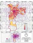
Based on the data sanitation and their georeferenced processing, we reached the map with the classification of walking trips made daily by older adults in the city of São Paulo (Figure 1). From it, we can observe that the three OD Zones with more destinations for older adults on foot (in absolute numbers) are: Higienópolis, Oscar Freire and República. The first and second recorded 45 walking trips and the third recorded 42. However, by analyzing the same data based on the total of pedestrians (in every age group) on these three zones, the OD Zone Oscar Freire had higher participation of older adults, with 38.13%, followed by the OD Zone República with 34.71% and finally Higienópolis with 29.41%.
Thus, the data was charted in two pictures. Chart 1 regards results in absolute numbers; and Chart 2 regards them by percentage related to the total of walking destinations of every age group of that particular OD Zone. It is interesting to observe that the results are not the same. While in Chart 1 there are only two OD Zones out of the Expanded City Center of São Paulo (Jardim Miriam and Gomes Cardim), in Chart 2 there are several OD Zones out of this Center.
According to Chart 1, it is possible to observe that older adults have OD Zones located in the Expanded City Center of São Paulo as destination. Among the first 20, only two are outside the City Center. However, when the percentage is made around the total of walking trips, there are differences in results, with predominance of Zones in the South Side of São Paulo (Chart 2). Nevertheless, this work chose to use the absolute values of walking destinations of older adults as a criterion for the selection of studied areas. This choice aims to identify the OD Zones with higher effective concentration of pedestrian commuting, and not only those where older adults participate proportionately more regarding the total commutes. Although the use of percentages is useful for comparative analysis, it could evidence zones with low sample representativeness. However, the absolute results allow us to highlight the territories with greater real volume of commutes, which proves to be more coherent with the goal of selecting cases with empirical relevance and significant density of records.
In sum, the data in Chart 1 show that the most frequented OD Zones by walking older adults are spaces in the city that are already consolidated urbanistically, meaning that they have basic sidewalk infrastructure, public lighting and pluvial drainage. However, it does not mean that these areas are free from floods. To evaluate this issue, the OD Zones Higienópolis and República were elected as case studies, since they presented the highest amounts of walking trips of older adults.
The OD Zone Higienópolis and the Flood Susceptibility Index (FSI)
The OD Zone Higienópolis is found within the district of Consolação, which, in turn, is located within the subprefecture of Sé. It covers an area of 67.81 ha and, based on the data from the previous section, it has the attraction of 45 walking trips by older adults – the highest revealed by the OD Survey 2023 (Metrô, 2025)
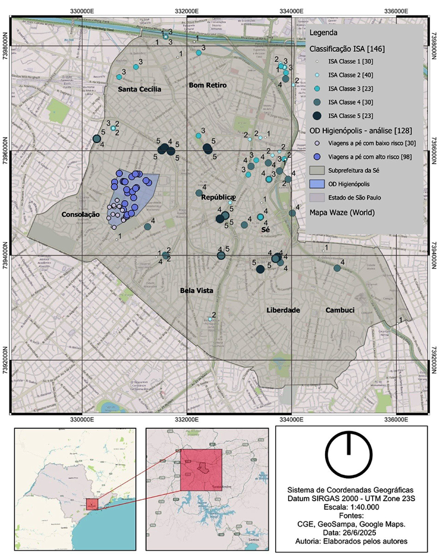
From the application of FSI over georeferenced data of the older population mobility, an analysis of spatial intersection was made in the OD Zone Higienópolis, located in the Consolação district (Figure 2). The overlay between the 45 walking destinations made by older adults, according to OD Survey 2023 (Metrô, 2025), and the points classified by the FSI in the current scenario resulted in 128 geographic intersections.
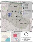
– Spatial distribution of the Flood Susceptibility Index (FSI) in the subprefecture of Sé and walking trips by older adults in the OD Zone Higienópolis
This variety of records occurs because the same destination point may be equidistant from two or more flooding points nearby, which is coherent with the logic of the spatial method adopted. The same destination point might be equidistant from two or more records of floods located within a 50 meters radius – criterion adopted to define spatial proximity between events, coherent with the micro urban scale analyzed.
After the spatial intersection between the destination points of older adults and the records of floods classified by the FSI, we verified that 98 of 128 records (76.6%) were located in areas of high or very high susceptibility to floods (classes 4 and 5). It is important to highlight that the values used in this overlay derive from FSI in their totality, composed by the four dimensions that structure it – physical, environmental, socioeconomic and infrastructural. Therefore, the final classification results from the multicriteria combination of these four dimensions, as established in the original formulation of the method. This data reveals a critical overlay between pedestrian mobility of the older adult population and the areas of urban flooding risk. Although the OD Zone of Higienópolis is located in a consolidated area in terms of infrastructure, the fact that over three quarters of walking trips happen under elevated flood risk reinforces the vulnerability of older pedestrians when walking around the urban network, keeping in mind that their slower walking pace and reduced visual acuity can lead to accidents such as slipping or falling on the sidewalks (Carunchio, 2023).
The map of Figure 2 illustrates this spatial overlap: the dark-blue-colored dots represent commutes of older adults that happen in areas of elevated risk, while the light-blue-colored dots indicate journeys in areas of low or moderate risk. The regions with higher concentration of records of floods match the main destinations of older pedestrians within the area analyzed, which points to an overlay between commuting flows and areas of environmental vulnerability. This configuration suggests limitations in urban infrastructure for drainage and circulation, especially in contexts of accident relief and high impermeabilization – recurring traits in the central urban network of São Paulo (Marengo et al., 2020; Tucci, 2008). Even though this analysis is restricted to the studied case, it can be a reflection of a pattern observed in other consolidated areas of the metropolis of São Paulo.
The OD Zone República and the Flood Susceptibility Index (FSI)
The OD Zone República is found within the district of República, which, in turn, is located within the subprefecture of Sé, with an area of 74.95 ha. It attracts 42 walking destinations for older adults on foot.
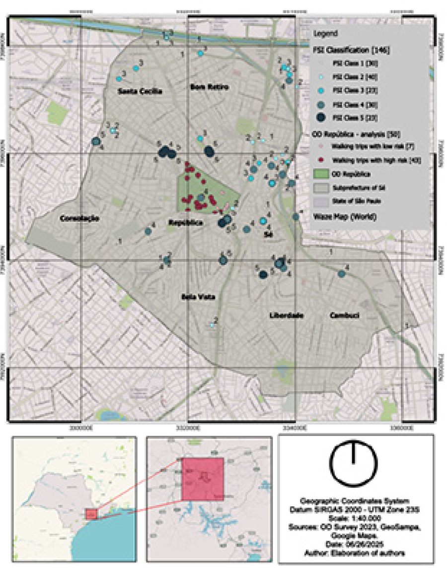
The map in Figure 3 presents the OD Zone República and its respective results. The data shows an even stronger pattern of overlay between mobility of older pedestrians and critical flooding areas. From 50 spatial intersections generated between walking destinations for older adults and points of the FSI in the current scenario, 43 (86%) occurred on spots classified with high or very high susceptibility to floods (classes 4 and 5). This concentration of commuting in climatic risk areas significantly elevates the urban vulnerability of this age group.
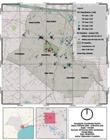
– Spatial distribution of the Flood Susceptibility Index (FSI) in the subprefecture of Sé and walking trips by older adults in the OD Zone República
– Comparative between OD zones: older pedestrian mobility and urban climatic risk (Flood Susceptibility Index, current scenario)
Conclusion
The results obtained in this study evidence a concerning overlap between older pedestrian mobility and the zones of high susceptibility for floods in the city of São Paulo. The application of FSI in two zones highly attractive for walking destinations by people aged 60 years or more – Higienópolis and República – revealed that, respectively, 76.6% and 86% of the records of commuting occur in areas classified as high or very high susceptibility. These findings point to the urgent need to integrate climate risk parameters into urban walkability plans, especially in already consolidated central areas, where high commuting density and existing infrastructure alone are insufficient to ensure safety during hydrometeorological emergencies.
The geospatial analysis demonstrated the potential of the GIS as instruments for intersectional diagnosis of urban vulnerabilities, allowing to identify amplified risk zones with precision. When confronting variables of mobility on foot, age group and climate risk, this article reinforces the importance of an integrated approach in urban planning, which can consider individuals in their multiple dimensions of vulnerability.
It is important to recognize, however, a methodological limitation in this study: the data from OD Survey 2023 (Metrô, 2025) was used here to observe only the final destinations of trips, without representing the path traveled between each older adult’s origin and destination. This restriction implicates that the risk analysis is limited to the point of arrival, not covering possible intermediate exposures along the way. Future studies can overcome this limitation through integration of continuous spatial tracking, both in QGIS and in GPS data, mobile sensors or field observation – capable of representing the risk along the walking trip more completely.
The promotion of a more accessible, resilient and safe city for active aging requires that walking trips are treated not only as daily practice, but as an urban right intersected by environmental, infrastructural and social issues.
Acknowledgements
This work was done with support of National Council for Scientific and Technological Development (CNPq) and São Paulo Research Support Foundation (FAPESP), Brazil. Process n. 2023/15898-4 and Process n. 2024/01097-2.
References
- ABNT - Associação Brasileira de Normas Técnicas (2021). NBR 9050: Acessibilidade a edificações, mobiliário, espaços e equipamentos urbanos. Rio de Janeiro, ABNT.
- ALBALA, P. L. R. (2022). Percursos de pedestres: caminhabilidade, conforto ambiental e planejamento estratégico. Tese de doutorado. São Paulo, Universidade de São Paulo.
-
ALVES, C. A.; DUARTE, D. H. S.; GONÇALVES, F. L. T. (2016). Residential buildings' thermal performance and comfort for the elderly under climate changes context in the city of São Paulo, Brazil. Energy and Buildings, v. 114, n. 1, pp. 62-71. DOI: 10.1016/j.enbuild.2015.06.044. Disponível em: https://www.sciencedirect.com/science/article/abs/pii/S0378778815300736?via%3Dihub
» https://doi.org/10.1016/j.enbuild.2015.06.044» https://www.sciencedirect.com/science/article/abs/pii/S0378778815300736?via%3Dihub -
AMORIM-MAIA, A. T.; OLAZABAL, M. (2025). Beyond adjustment: A new paradigm for climate change adaptation in a complex world. Global Environmental Change, v. 93, n. 1, pp. 1-14. DOI: 10.1016/j.gloenvcha.2025.103027. Disponível em: https://www.sciencedirect.com/science/article/pii/S0959378025000640?via%3Dihub
» https://doi.org/10.1016/j.gloenvcha.2025.103027» https://www.sciencedirect.com/science/article/pii/S0959378025000640?via%3Dihub -
APPOLLONI, L. et al. (2020). Walkable urban environments: an ergonomic approach of evaluation. Sustainabilit y, v. 12, n. 20, pp. 1-31. DOI: 10.3390/su12208347. Disponível em: https://www.mdpi.com/2071-1050/12/20/8347
» https://doi.org/10.3390/su12208347» https://www.mdpi.com/2071-1050/12/20/8347 -
BIESBROEK, R. et al. (2022). Policy attention to climate change impacts, adaptation and vulnerability: a global assessment of National Communications (1994-2019). Climate Policy, v. 22, n. 1, pp. 997-111. Disponível em: https://www.tandfonline.com/doi/abs/10.1080/14693062.2021.2018986%4010.1080/tfocoll.2022.0.issue-Adaptation-Climate-Policy DOI: 10.1080/14693062.2021.2018986.
» https://doi.org/10.1080/14693062.2021.2018986» https://www.tandfonline.com/doi/abs/10.1080/14693062.2021.2018986%4010.1080/tfocoll.2022.0.issue-Adaptation-Climate-Policy -
BRASIL. Ministério da Economia (2023). Sistema de Informação Geográfica (SIG), online. Disponível em: https://www.gov.br/economia/pt-br/assuntos/patrimonio-da-uniao/arquivos-anteriores-privados/programa-de-modernizacao/linha-do-tempo/34-sig-apostila.pdf/view Acesso em: 23 jun 2025.
» https://www.gov.br/economia/pt-br/assuntos/patrimonio-da-uniao/arquivos-anteriores-privados/programa-de-modernizacao/linha-do-tempo/34-sig-apostila.pdf/view - CARUNCHIO, C. F. (2023). O meio urbano como indutor do envelhecimento ativo: desempenho ergonômico com foco no usuário idoso. Dissertação de mestrado. São Paulo, Universidade de São Paulo.
-
CARVALHO, G. L. L. et al. (2023). Percursos iguais, experiências distintas: discussões de possíveis caminhos para ferramenta de avaliação da caminhabilidade incluindo a interseccionalidade. Scientific Journal ANAP, v. 1, n. 3, pp. 1117-1131. Disponível em: https://publicacoes.amigosdanatureza.org.br/index.php/anap/article/view/3874 Acesso em: 23 jun 2025.
» https://publicacoes.amigosdanatureza.org.br/index.php/anap/article/view/3874 -
CHINA, D. L. et al. (2021). Envelhecimento ativo e fatores associados. Kairós Gerontologia, v. 24, n. 29, pp. 141-156. DOI: 10.23925/2176-901X.2021v24i0p141-156. Disponível em: https://revistas.pucsp.br/index.php/kairos/article/view/53768 Acesso em: 23 jun 2025.
» https://doi.org/10.23925/2176-901X.2021v24i0p141-156» https://revistas.pucsp.br/index.php/kairos/article/view/53768 -
CRENSHAW, K. W. (1989). Demarginalizing the Intersection of race and sex: a black feminist critique of antidiscrimination doctrine, feminist theory and antiracist politics. University of Chicago Legal Forum, v. 1989, n. 1, pp. 139-167. Disponível em: https://chicagounbound.uchicago.edu/uclf/vol1989/iss1/8 Acesso em: 10 out 2025.
» https://chicagounbound.uchicago.edu/uclf/vol1989/iss1/8 -
DETOMI, I. (2023). Uma análise interseccional da mobilidade urbana: um direito social. Artigos Archdaily, online. Disponível em: https://www.archdaily.com.br/br/994552/uma-analise-interseccional-da-mobilidade-urbana-um-direito-social Acesso em: 23 jun 2025.
» https://www.archdaily.com.br/br/994552/uma-analise-interseccional-da-mobilidade-urbana-um-direito-social -
DI GIULIO, G. M. et al. (2018). Mainstreaming climate adaptation in the megacity of São Paulo, Brazil. Cities, v. 72, p. B, pp. 237-244. DOI: https://doi.org/10.1016/j.cities.2017.09.001 Disponível em: https://www.sciencedirect.com/science/article/pii/S0264275117300471
» https://doi.org/10.1016/j.cities.2017.09.001» https://www.sciencedirect.com/science/article/pii/S0264275117300471 - GEHL, J. (2013). Cidade para pessoas São Paulo, Perspectiva.
- GLAESER, E. (2016). O Triunfo da Cidade São Paulo, BEI.
-
IBGE - Instituto Brasileiro de Geografia e Estatística (2023). Censo Demográfico 2022: População das Cidades Brasileiras. Instituto Brasileiro de Geografia e Estatística, 2022. Disponível em: https://censo2022.ibge.gov.br/panorama/ Acesso em: 16 jun 2025.
» https://censo2022.ibge.gov.br/panorama/ -
IPCC - Intergovernmental Panel on Climate Change (2023). Climate Change 2023: Synthesis Report. Contribution of Working Groups I, II and III to the Sixth Assessment Report of the Intergovernmental Panel on Climate Change [Core Writing Team, H. Lee and J. Romero (eds.)]. Geneva, Suíça. DOI: 10.59327/IPCC/AR6-9789291691647.
» https://doi.org/10.59327/IPCC/AR6-9789291691647 - ISAAC, S. M. (2025). Índice de Suscetibilidade de Alagamento (ISA) em áreas urbanas: análise multicritério para a resiliência urbana. Tese de doutorado. São Paulo, Universidade de São Paulo.
- JOVCHELOVITCH, S. (2019). Cidades e modos de vida: experiências de envelhecimento em contextos urbanos desiguais São Paulo, Fundação Perseu Abramo.
-
JUHOLA, S. et al. (2024). A new dynamic framework is required to assess adaptation limits. Global Environmental Change, v. 97, n. 1, pp. 1-7. DOI: 10.1016/j.gloenvcha.2024.102884. Disponível em: https://www.sciencedirect.com/science/article/pii/S0959378024000888
» https://doi.org/10.1016/j.gloenvcha.2024.102884» https://www.sciencedirect.com/science/article/pii/S0959378024000888 - KRONKA MÜLFARTH, R. C. (2022). Repensando ergonomia: do edifício ao espaço urbano. Rio de Janeiro, LTC.
-
KRONKA MÜLFARTH, R. C. et. al. (2024). Género y caminabilidad. Estudios de caso en la ciudad de São Paulo. Ensayo Arquitectura PUCP, v. 5, pp. 77-97. DOI: 10.18800/ensayo.202405.004. Disponível em: https://revistas.pucp.edu.pe/index.php/ensayo/article/view/30175
» https://doi.org/10.18800/ensayo.202405.004» https://revistas.pucp.edu.pe/index.php/ensayo/article/view/30175 -
LIMA, G. N.; RUEDA, V. O. M. (2018). The urban growth of the metropolitan area of Sao Paulo and its impact on the climate. Weather and Climate Extremes, v. 21, n. 1, pp. 17-26. DOI: 10.1016/j.wace.2018.05.002. Disponível em: https://www.sciencedirect.com/science/article/pii/S2212094718300082
» https://www.sciencedirect.com/science/article/pii/S2212094718300082 -
MARENGO, J. A. et al. (2020). Trends in extreme rainfall and hydrogeometeorological disasters in the Metropolitan Area of São Paulo: a review. The New York Academy of Sciences, v. 1472, n. 1, pp. 5-20. DOI: 10.1111/nyas.14307. Disponível em: https://nyaspubs.onlinelibrary.wiley.com/doi/full/10.1111/nyas.14307
» https://doi.org/10.1111/nyas.14307» https://nyaspubs.onlinelibrary.wiley.com/doi/full/10.1111/nyas.14307 -
PANAHI, M. M.; MOAYERIAN, N. (2025). Seeds of resilience: How social capital cultivates community strength in environmental crisis management. Journal of Environmental Management, v. 380, n. 1, pp. 1-10. DOI: 10.1016/j.jenvman.2025.124937. Disponível em: https://www.sciencedirect.com/science/article/abs/pii/S0301479725009132
» https://doi.org/10.1016/j.jenvman.2025.124937» https://www.sciencedirect.com/science/article/abs/pii/S0301479725009132 -
PREFEITURA MUNICIPAL DE SÃO PAULO. (2024). São Paulo supera a marca de 2 milhões de idosos, aponta estudo da Prefeitura. Notícia na íntegra, online. Disponível em: https://prefeitura.sp.gov.br/w/s%C3%A3o-paulo-supera-a-marca-de-2-milh%C3%B5es-de-idosos-aponta-estudo-da-prefeitura Acesso em: 23 jun 2025.
» https://prefeitura.sp.gov.br/w/s%C3%A3o-paulo-supera-a-marca-de-2-milh%C3%B5es-de-idosos-aponta-estudo-da-prefeitura -
OLIVEIRA, J. A. P.; BHUIYAN, S. (2024). Cities and climate change in developing countries. Urban Climate, v. 58, n. 1, pp. 1-4. DOI: 10.1016/j.uclim.2024.102169. Disponível em: https://www.sciencedirect.com/science/article/abs/pii/S2212095524003663
» https://doi.org/10.1016/j.uclim.2024.102169» https://www.sciencedirect.com/science/article/abs/pii/S2212095524003663 -
ROLNIK, R.; KLINTOWITZ, D. (2011). (I)mobilidade na cidade de São Paulo. Estudos Avançados, v. 25, n. 71, pp. 899-108. DOI: 10.1590/S0103-40142011000100007. Disponível em: https://www.scielo.br/j/ea/a/xM3HNxRtNM5RqtjttKjxgJb/?lang=pt
» https://doi.org/10.1590/S0103-40142011000100007» https://www.scielo.br/j/ea/a/xM3HNxRtNM5RqtjttKjxgJb/?lang=pt -
SANTORO, P. F.; RODRIGUES, S. (2023). A abordagem de gênero e interseccional nos planos diretores. Fórum SP 22/23, v. 1, n. 1, pp. 1-16. Disponível em: https://www.labcidade.fau.usp.br/wp-content/uploads/2024/02/artigo-fo%CC%81rum-SP-23_ge%CC%82nero-e-pd_paulasamira_final.pdf Acesso em: 20 jun 2025.
» https://www.labcidade.fau.usp.br/wp-content/uploads/2024/02/artigo-fo%CC%81rum-SP-23_ge%CC%82nero-e-pd_paulasamira_final.pdf - SANTOS, M.; de HOLANDA, F. (2018). Mobilidade urbana e acessibilidade para idosos: caminhos de inclusão em cidades brasileiras. Cadernos de Arquitetura e Urbanismo, n. 15, pp. 50-67.
- SATO, A. E. (2021). Streetscapes para São Paulo: caminhabilidade & ergonomia. Dissertação de mestrado. São Paulo, Universidade de São Paulo.
-
SEADE - Fundação Sistema Estadual de Análise De Dados (2021). SEADE informa demografia: população paulista em 2021. Disponível em: https://informa.seade.gov.br/populacao-paulista-2021/ Acesso em: 16 jun 2025.
» https://informa.seade.gov.br/populacao-paulista-2021/ - TUCCI, C. E. M. (2008). Gestão da drenagem urbana Porto Alegre, Associação Brasileira de Recursos Hídricos (ABRH).
-
VALENTE, F.; LAURINI, M. (2022). Urban climate change: a statistical analysis for São Paulo. Urban Climate, v. 41, n. 1, pp. 1-18. DOI: 10.1016/j.uclim.2021.101077. Disponível em: https://www.sciencedirect.com/science/article/abs/pii/S2212095521003072
» https://doi.org/10.1016/j.uclim.2021.101077» https://www.sciencedirect.com/science/article/abs/pii/S2212095521003072 -
VEIGA, C. et al. (2024). Urban computing for climate and environmental justice: early perspectives from two research initiatives. Computers and Society, v. 1, pp. 1-4. DOI: 10.48550/arXiv.2410.04318. Disponível em: https://arxiv.org/abs/2410.04318
» https://doi.org/10.48550/arXiv.2410.04318» https://arxiv.org/abs/2410.04318

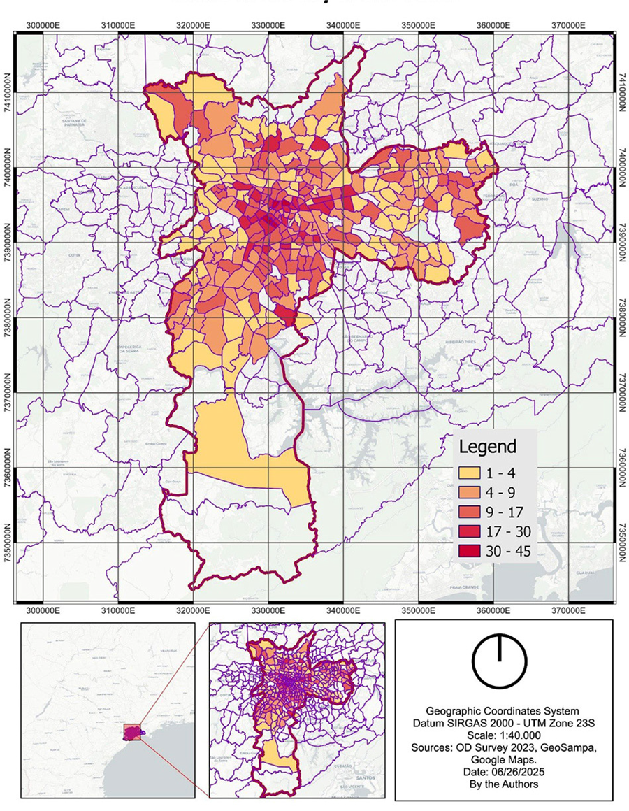 Source: elaboration of authors, in 2025.
 Source: elaboration of authors, in 2025.
 Source: elaboration of authors, in 2025.