
 Blueprint framework for Integrated Water Resources Management (IWRM): dashboard for the Tapajos River basin
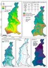
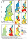
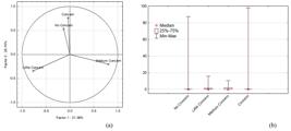
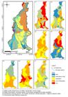
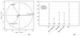
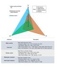
The Tapajós River basin is one of the largest tributaries of the Amazon River (on the right bank) and flows through the territories of four Brazilian states. Its complexity translates to the different physiographic aspects, from protected areas defined in part of its territory (indigenous lands and conservation units) to the economic potential (agricultural and mineral) and social pressure from the forming municipalities. In response to this setting, the objective developed was to describe a Blueprint Framework (BF) scenario, taking as reference the forming municipalities and the main factors that affect the development of cities. The processing consisted of developing the Trends and Pressure Framework (TPF) and City Blueprint Performance Framework (CBF), defining the Governance Capacity Framework (GCF), and reclassification by major groupings. The data gathering construction used public sources grouped the social, environmental, and economic dimensions. The results emphasized that the Tapajós River basin is a fragmented and heterogeneous region, and the critical sub-basins are Jamanxin, Teles Pires, and Juruena. The municipal indicators and the river’s active area establish a division between the medium-high and medium-low courses, increasing water insecurity and indicating that having water availability in the river basin does not mean immediate social and economic access to the resource.
Keywords:
Water security; Governance; Environmental management
 Thumbnail
 Thumbnail
 Thumbnail
 Thumbnail
 Thumbnail
 Thumbnail
 Thumbnail
 Thumbnail


