 Environmental inequities in the metropolis of São Paulo, Brazil: vegetation, heat, and air pollution according to social vulnerability
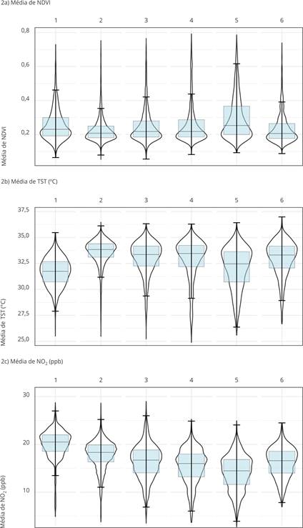
Socio-environmental inequalities in large cities affect health in different degrees, more greatly impacting poorer populations. This study analyzed the distribution of urban vegetation (estimated by the Normalized Difference Vegetation Index - NDVI), land surface temperature (LST), and nitrogen dioxide concentrations (NO2) in the Metropolitan Area of São Paulo, Brazil, according to vulnerability groups defined by the São Paulo Social Vulnerability Index (IPVS). Urban census tracts were used as the unit of analysis in this ecological study. The NDVI and LST were obtained by remote sensing and NO2 were derived from a high-resolution global model based on land use regression. Statistical summaries compared the indicators between the IPVS groups (1 - very low to 6 - very high vulnerability). NDVI medians scarcely varied (0.21-0.25) and showed no linear pattern; the high vulnerability group had higher values (possibly due to their peri-urban location). The group with very low vulnerability showed the lowest LST median (31.8ºC). NO2 concentrations showed a downward trend between the less and highly vulnerable groups, with a further increase in the latter. The Metropolitan Area of São Paulo shows heterogeneous environmental exposure without a linear pattern regarding social vulnerability. The most vulnerable areas accumulating critical environmental conditions require particular attention, reinforcing the need for integrated public policies to reduce inequalities and promote healthier and more equitable municipalities.
Keywords:
Environmental Health; Urban Health; Health Inequities; Environmental Justice; Environmental Indicators
 Thumbnail
 Thumbnail
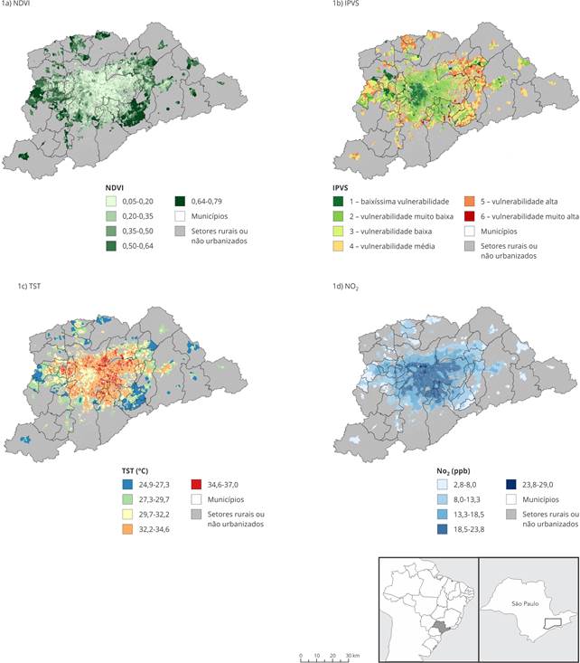 IPVS: Índice Paulista de Vulnerabilidade Social.