 Geoheritage Assessment of the Akhuryan-Shirak Volcanic Region (NW Armenia) and its Potential for UNESCO Global Geopark Designation
Abstract
The proposed Akhuryan-Shirak Volcanic Geopark, located in northwestern Armenia within Shirak Province, represents a unique assemblage of geological, geomorphological, hydrological, and cultural heritage features. Covering an area of approximately 1,700 km² and bordering Turkey to the west and Georgia to the north, the region is characterized by Quaternary volcanic formations, including basaltic plateaus, river gorges, and diverse landforms shaped by tectonic and erosional processes. The objective of this study is to evaluate the geoheritage and geomorphological characteristics of the Akhuryan-Shirak volcanic region and assess its potential for designation as a UNESCO Global Geopark. The research methodology includes field surveys, geomorphological and terrain mapping, digital elevation model (DEM) analysis, GIS-based spatial analysis, and the inventory and qualitative assessment of key geosites and associated cultural landmarks. The results identify several sites of outstanding geoheritage value, including Lake Arpi National Park, the Akhuryan River canyon, Trchkan Waterfall, and numerous mineral springs. In addition, important cultural monuments such as Marmashen Monastery, Vahramaberd Fortress, and the Urartian inscription of King Argishti I highlight the strong interaction between geological processes and human history in the region. The analysis indicates that the proposed geopark area possesses significant scientific, educational, and geotourism potential. The establishment of the Akhuryan-Shirak Volcanic Geopark would provide an integrated framework for scientific research, environmental conservation, and community-based geotourism development. Furthermore, the geopark could strengthen Armenia’s representation within the UNESCO Global Geopark Network and contribute to sustainable regional development while promoting the interaction between natural heritage and cultural identity in the Shirak region.
Keywords:
Transboundary geoparks; Geoturism development; DEM and GIS spatial analysis
Resumo
O proposto Geoparque Vulcânico Akhuryan-Shirak, localizado no noroeste da Armênia, na província de Shirak, representa um conjunto único de elementos de patrimônio geológico, geomorfológico, hidrológico e cultural. Abrangendo uma área de aproximadamente 1.700 km² e fazendo fronteira com a Turquia a oeste e a Geórgia a norte, a região é caracterizada por formações vulcânicas quaternárias, incluindo planaltos basálticos, gargantas fluviais e diversas formas de relevo moldadas por processos tectônicos e erosivos. O objetivo deste estudo é avaliar as características de geo-patrimônio e geomorfológicas da região vulcânica de Akhuryan-Shirak e analisar o seu potencial para a designação como Geoparque Global da UNESCO. A metodologia de investigação inclui trabalho de campo, mapeamento geomorfológico e do terreno, análise de modelos digitais de elevação (DEM), análise espacial baseada em SIG (GIS), bem como o inventário e a avaliação qualitativa dos principais geossítios e dos marcos culturais associados. Os resultados identificam vários locais de elevado valor de geo-patrimônio, incluindo o Parque Nacional do Lago Arpi, o cânion do rio Akhuryan, a Cascata de Trchkan e numerosas fontes minerais. Além disso, importantes monumentos culturais, como o Mosteiro de Marmashen, a Fortaleza de Vahramaberd e a inscrição urartiana do rei Argishti I, evidenciam a forte interação entre os processos geológicos e a história humana na região. A análise indica que a área proposta para o geoparque possui um significativo potencial científico, educativo e de geoturismo. A criação do Geoparque Vulcânico Akhuryan-Shirak proporcionaria um quadro integrado para investigação científica, conservação ambiental e desenvolvimento do geoturismo baseado na comunidade. Além disso, o geoparque poderia reforçar a representação da Armênia na Rede Global de Geoparques da UNESCO e contribuir para o desenvolvimento regional sustentável, promovendo simultaneamente a interação entre o patrimônio natural e a identidade cultural na região de Shirak.
Palavras-chave:
Geoparques transfronteiriços; desenvolvimento do geoturismo; Análise espacial com DEM e GIS
1 Introduction
The Geopark concept emphasizes a bottom-up approach, encouraging active participation of local communities and fostering sustainable socio-economic development through geotourism, education, and conservation initiatives (UNESCO 2023).
The ecological significance of the region is further highlighted by its biodiversity, including the endemic and migratory bird populations of Lake Arpi, the habitats of the Darevski viper, and ongoing forest restoration efforts. Collectively, these natural and cultural attributes underscore the potential of establishing the Akhuryan-Shirak Volcanic Geopark as a site of international geological and cultural importance, promoting geodiversity conservation, sustainable tourism, and local socio-economic resilience.
The northwestern part of the Republic of Armenia, encompassing much of Shirak Province, represents a significant convergence of geological, ecological, and cultural heritage. Bordering Turkey and Georgia, this landscape comprises volcanic highlands, river valleys, mineral springs, and waterfalls, framed by the Pambak, Shirak, Yeghnakhagh, and Bazum mountain ranges. Its geomorphological diversity-including the Akhurian River terraces, Quaternary volcanic formations, and remnants of the Meso-Tethys suture-reflects a complex geological history spanning from the Jurassic to the Quaternary periods (Shalaeva et al. 2019; Balyan 1986).
The region is also rich in cultural landmarks, such as the Urartian inscription of King Argishti I, (Encyclopaedia Britannica 2025). According to UNESCO (2023), UNESCO Global Geoparks (UGGps) are unified geographical areas where sites and landscapes of international geological significance are managed within a comprehensive framework of protection, education, and sustainable development. These territories leverage their geological heritage, alongside the area’s natural and cultural values, to promote sustainable resource use, raise awareness of climate change, and mitigate risks associated with natural hazards. The geopark concept emphasizes a bottom-up approach, encouraging active participation of local communities and fostering sustainable socio-economic development through geotourism, education, and conservation initiatives (UNESCO 2023; Ferreira & Valdati 2022).
Since its establishment in 1972, the UNESCO World Heritage Convention has recognized the value of geodiversity and remains the longest-standing international instrument for its conservation. The International Union for Conservation of Nature (IUCN), as a founding organization and advisor on natural heritage, has played a pivotal role in advancing geodiversity science and practice (UNESCO 1972; Nieto-Albert 2023). The ecological significance of the region is further highlighted by its biodiversity, including the endemic and migratory bird populations of Lake Arpi, the habitats of the Darevski viper, and ongoing forest restoration efforts.
The objective of this study is to evaluate the geoheritage and geomorphological characteristics of the Akhuryan-Shirak volcanic region and assess its potential for designation as a UNESCO Global Geopark. The region’s features indicate not only local and international significance but also its potential to develop into a transregional geopark, encompassing Armenia’s borderlands and potentially integrating with complementary geopark initiatives in neighboring Turkey and Georgia. Collectively, the geological, ecological, and cultural attributes of the area underscore its international and transregional potential, which can promote geodiversity conservation, sustainable tourism, and local socio-economic resilience.
2 Materials and Methods
2.1 Case Study Area
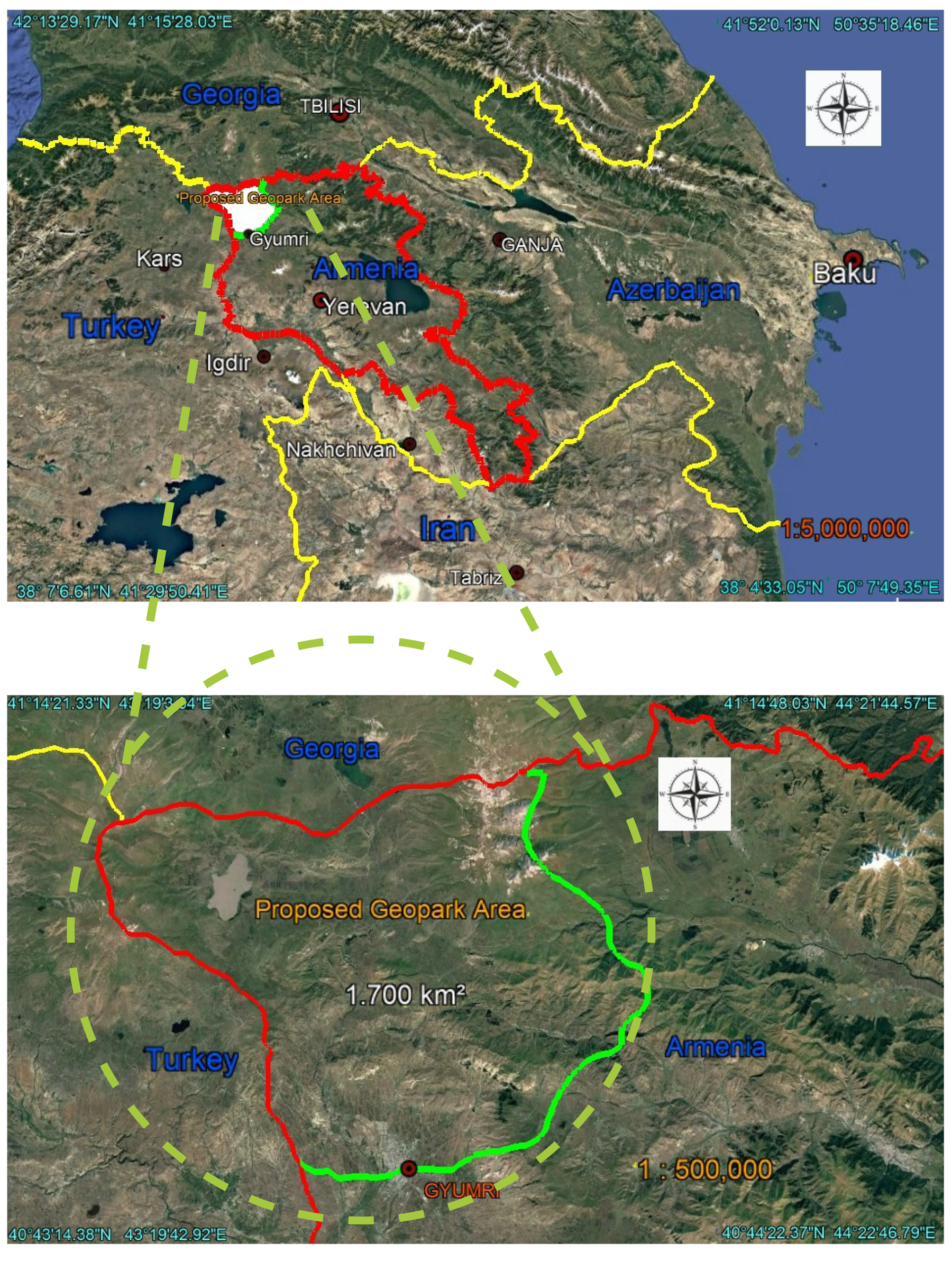
The proposed geopark is located in the northwestern part of the Republic of Armenia (Figure 1) and is bounded by the Republic of Turkey to the west and the Republic of Georgia to the north. The territory encompasses a significant portion of Shirak Province and extends over approximately 1.700 km ².

Location of the proposed Akhuryan-Shirak Volcanic Geopark. Maps prepared by the authors based on satellite imagery from Google Earth Pro (2026).
The study area encompasses a diverse array of natural, geological, hydrological, historical, and cultural landmarks. Notable natural and geological features include Lake Arpi, the Akhuryan River and its canyon, Trchkan Waterfall, and the mineral springs of Krasar and Mets Sepasar. Significant historical and cultural sites comprise the Marmashen Monastery complex, Vahramaberd Fortress, the Krasar triple-arch bridge, the Urartian inscription of King Argishti I (BCE), and the St. Hovhannes pilgrimage site (Hartagyugh). The region is framed by the Pambak, Shirak, Yeghnakhagh, and Bazum mountain ranges, which constitute its geomorphological context (Figure 2A).

The proposed Akhuryan-Shirak Geopark: (A) Spatial distribution of key natural and cultural heritagesites; (B) Transportation network and main natural and cultural landmarks; (C) Elevation map pf the study area. Maps prepared by the authors based on satellite imageryfrom Google Earth Pro (2026).
The proposed geopark area is characterized by a well-developed transportation network, encompassing both interstate and local roads that ensure efficient connectivity among major settlements, significant natural landmarks, and key geosites. This accessibility significantly enhances the region’s potential for geotourism development, scientific research, and sustainable local mobility (Figure 2B).
The Shirak Basin is situated at elevations ranging from 1.500 to 1.700 m a.s.l. (Figure 2C) showing the elevation map. The basin is predominantly filled with Quaternary terrigenous sediments and volcanic rocks. From north to south, it is drained by the Akhuryan River, which incises into the basin floor by up to several tens of meters. The average elevations of the surrounding ridges range between 2.000 and 2.500 m.
The northern part of the basin is delimited by the western chain of the Bazum Ridge and its southern extension, the Shirak Ridge. These ridges are composed of Paleogene, Cretaceous, and Jurassic rocks, incorporating fragments of the Meso-Tethys suture, which is regarded as the western continuation of the Sevan-Hakari ophiolite zone. The eastern boundary of the basin is defined by the Pambak Ridge, separating it from the Sevan Basin. The eastern and central sections of the ridge consist predominantly of Eocene rocks, including extensive lava flows and volcanoclastic sediments. In the vicinity of Spitak and the Shirak Basin, Cretaceous rocks of the southern Tethys facies, as well as Late Cenozoic andesites and basalts, are exposed.
The southern margin of the Shirak Basin lacks a prominent structural boundary but can be associated with the Aragats volcanic center, active approximately between 1.0 and 0.45 Ma, and with remnants of the older rhyolite-dacite Arteni volcano. The southernmost point of the basin is located near the village of Haykadzor and the medieval city of Ani, with its southwestern limit formed by Upper Miocene and Pliocene volcanic rocks of the Ani area. The western boundary is defined by the volcanic Kars-Digor Highland, comprising Late Miocene to Pleistocene lavas and tuffs of varied composition.
The region experienced intense folding and faulting during the late Eocene and Oligocene. Exposures of Lower and Middle Miocene formations are limited, although Lower Miocene alkaline basalts occur at the Jajur Pass, and uppermost Oligocene basaltic andesites are present in the southern basin (Shalaeva et al. 2019).
2.1.1 Case Study Area of Lake Arpi
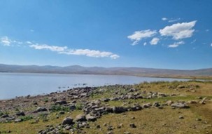
Lake Arpi, situated in the extreme northwestern corner of Armenia on the Javakhk-Shirak Plateau near the borders with Turkey and Georgia, forms part of the same ecosystem as the Javakheti Protected Areas in Georgia (Figure 3) (Caucasus Nature Fund, Lake Arpi National Park). The lake is located at an elevation of 2.023 m and has a volcanic origin (Overland Armenia, Lake Arpi). Lake Arpi National Park encompasses the lake itself along with several smaller lakes, rivers, and wetlands, which collectively provide habitats for a wide diversity of local and migratory bird species. Notably, the park supports the world’s largest colony of Armenian gulls and represents the only breeding site in Armenia for the Dalmatian pelican. The area is also the only known habitat of the Darevski viper, and in summer its meadows host approximately 90 butterfly species.
This remote and largely undisturbed region offers opportunities for a variety of recreational and ecotourism activities, including bird watching, mountain and tour biking, sport fishing, and horseback riding (Caucasus Nature Fund, Lake Arpi National Park). The lakes and wetlands provide excellent bird watching sites, with breeding birds observable from May to July and migratory birds resting during spring and autumn. Most of the gravel roads in the park are suitable for mountain and tour biking during the summer months. Horseback riding is available near Darik village, typically from May to October. Additionally, the Lake Arpi region, with snow cover for nearly half the year, offers ideal conditions for cross-country skiing, with equipment rental and guided services accessible in Mets Sepasar, Ashotsk, and through Shirak tours based in Gyumri (Ramsar Sites Information Service 2011).

2.1.2 Case Study Area of Mineral Water Springs Near Krasar Village
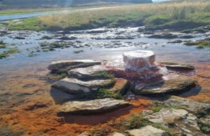
In the northwestern part of the Shirak region, within the valley of the Arpacha River-a tributary of the Akhurian River- laid the villages of Krasar and Mets Sepasar, which are renowned for their carbonated mineral springs (Figure 4). The high concentration of dissolved minerals results in reddish deposits surrounding the springs, rendering them visually distinctive within the landscape. Geological investigations of the area have been conducted since the Soviet period, during which the springs were documented and analyzed. Nevertheless, a comprehensive hydrogeological understanding of their origin and dynamics remains incomplete, and further detailed geological and geochemical studies are required to elucidate their formation processes and mineral composition (Martikyan 2022).

Mineral water springs near Krasar village, Shirak region. Photos by Lioba Buchholz (2025), used with permission.
2.1.3 Case Study Area of Architectural Heritage - The Krasar Triple-Arch Bridge
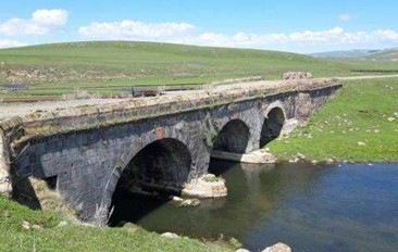
Approximately 2 km southwest of Krasar village, spanning a tributary of the Akhurian River, stands the Krasar Triple-Arch Bridge (Figure 5). The bridge is constructed of black and red rough-hewn tuff stones, with finely dressed blocks forming the arch edges. It represents an important 19th-century engineering and architectural monument, distinguished by its three-span design and the traditional stone masonry techniques characteristic of Armenian architectural heritage (Monuments of Shirak Region, Krasar Bridge, 2024).

The Triple-Arch Bridge of Krasar, located southwest of Krasar village on a tributary of the Akhurian River. Photo from https://urgnalgyumrium.am/en/three-span-bridge-of-krasar-en/ (accessed 27 Oct 2025).
2.1.4 Case Study Area of Akhurian River
The Akhurian River, which originates from the Arpi Lake-Reservoir (Figure 6), has a total length of 186 km. The river’s highest and oldest terrace is the fifth terrace, the eroded remnants of which are observed in the upper gorge sections. This terrace consists of boulder deposits, widely distributed on adjacent hills at a relative elevation of 200-220 m above the river, and is dated to the Upper Pliocene. The fourth terrace coincides with the surface of the Shirak Plain and is well preserved, with an average elevation of approximately 1.650 m. It is composed of lacustrine clays of Mindel-Mindel-Riss age, pumice deposits, alluvial-proluvial clays, gravelly clays, and boulder deposits, many of which are capped by tuff layers. Locally, buried black soils occur beneath the tuff.
The second and third terraces are less distinctly expressed but remain relatively well preserved in the Gyumri area, where they merge along the Akhurian River channel. The fourth terrace exhibits a relative height ranging from 30 to 40 m and consists of lacustrine clays and alluvial clay-sand deposits. It is mainly distributed along the left bank of the river and is subject to intense erosional dissection. The elevations of these terraces correspond approximately to the Upper Quaternary, while the first terrace reaches a height associated with the Holocene (Balyan 1986).
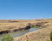
Akhurian River valley (middle course) near Marmashen Monastery. Photo by co-author (Sargis Sargsyan),2025.
2.1.5 Case Study Area of Scientific and Cultural Value - The Inscription of Argishti I
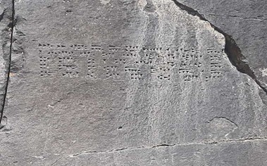
An Urartian inscription preserved within the study area is attributed, based on archaeological research, to the reign of King Argishti I (ca. 780-756 BCE) (Figure 7)․ The inscription is carved into basaltic rock, providing evidence of ancient habitation and cultural activity in the region, while also illustrating the close interconnection between the territory’s geomorphological and historical-cultural values. This interrelationship represents a key justification for the establishment of a geopark, as it integrates both:
Natural heritage, exemplified by the basaltic formations and the river valley; and
Historical-cultural heritage, exemplified by the Urartian inscription.

The Urartian inscription of King Argishti I carved on basalt rocks near Vahramaberd. Photo by co-author Sargis Sargsyan, 2025.
2.1.6 Case study Area of Marmashen Settlement and Necropolis
Within the area of Vahramaberd Fortress (Figure 8), the fortress is surrounded by basalt exposures (Figure 9). On one of its rocky slopes lies the Urartian inscription of King Argishti I, as noted above. In the same vicinity stands the Marmashen Monastery, with virtually no open space separating the two monuments. Adjacent to the monastery, archaeological investigations have identified a Bronze Age settlement dating to the 3rd millennium BCE, while to the east lies a necropolis from the 1st millennium BCE.
Excavations at the 3rd-millennium BCE site have also revealed a rare occupational layer from the 2nd millennium BCE, indicating continuous and dense habitation of the Marmashen area throughout prehistory and subsequent periods. Additionally, beneath the medieval cultural layers uncovered near the monastery, archaeologists have identified a further rich cultural stratum. Numerous findings of pottery fragments and ceramic vessels attest both to the material wealth of the site and to the existence of a developed, urbanized society in this region during the pre-Bagratid period. Comprehensive, large-scale excavations remain necessary to obtain more precise information concerning the culture and lifestyle of the inhabitants of this early settlement (Harutyunyan 2008).

Landscape of the ancient Vahramaberd settlement area. Photo by co-author Sargis Sargsyan, 2025.
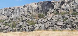
Basalt cliff exposure near the site of the ancient Vahramaberd settlement, illustrating the geomorphological features of the Akhurian River valley. Photo by co-author Sargis Sargsyan, 2025.
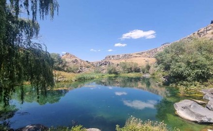
In the area of the Marmashen Monastery and Vahramaberd Fortress, there is an ancient cemetery and a small lake locally known as Nadia Lake or “Blue Water” (Figure 10).

2.1.7 Case study Area of Architectural Heritage - The Marmashen Monastery Complex
Located on the left bank of the Akhuryan River near the village of Vahramaberd, the Marmashen Monastery-constructed between 988 and 1029 CE by Prince Vahram Pahlavuni-represents one of the finest examples of medieval Armenian architecture (Figure 11). The monastic complex was built using locally quarried reddish tuff and basalt, demonstrating the close relationship between regional geological resources and cultural heritage (Monuments of Shirak Region, 2024; Harutyunyan, n.d.). This use of volcanic materials in architectural design illustrates the strong interconnection between natural and cultural landscapes and reflects the core geopark concept, which emphasizes the linkage between geology, history, and human creativity.

Marmashen Monastery complex, located on the left bank of the Akhurian River, Shirak Province. Photos by Lioba Buchholz (2025), used with permission.
2.1.8 Case Study Area of Forests
Forests in the Caucasus play a significant social, environmental, and economic role. In northern Armenia, extensive forest degradation and overgrazing have resulted in habitat loss for endangered species and the disruption of key ecological functions. In response to these challenges, WWF Armenia, in cooperation with WWF Germany and WWF Switzerland, initiated the Forest Landscape Restoration in Northern Armenia project in 2012. One of the project’s priority sites was selected in the vicinity of Trchkan Waterfall (Figure 12) a designated Natural Monument of the Republic of Armenia. The protection of the waterfall became a symbolic example of environmental activism when, in 2011, public campaigns successfully prevented the construction of a hydroelectric power plant in the area. This case underscores the ecological importance of the region and demonstrates the critical role of community participation in nature conservation, in full accordance with the principles of the geopark concept (WWF Armenia 2012).
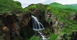
Trchkan Waterfall, Mets Parni, Lori Region, Armenia. Photo from ArmTrailsTour (accessed 27 Oct 2025).
2.1.9 Case Study Area of St. Hovhannes Chapel
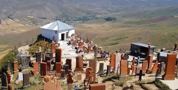
Near the village of Hartagyugh, perched on one of the hard-to-reach peaks of the Pambak mountain range, the St. Hovhannes Chapel has recently become a favorite pilgrimage site (Figure 13). According to tradition, the relics of St. John are buried at the location of this chapel. Situated at an altitude of 2.157 meters above sea level, it attracts numerous visitors each year.
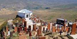
Saint Hovhannes Chapel (Ghaltakhchi), Hartagyugh. Photo from https://hyurservice.com/hy/attractions-activities-armenia/hovhannes-chapel-hartagyugh-ghaltakhchi, accessed 27 Oct 2025.
2.2 Methodology
This study employs an integrated approach combining field surveys, geomorphological mapping, and spatial analysis to assess the geoheritage of the Akhuryan-Shirak volcanic region. Field investigations were conducted across representative sites within the proposed geopark, documenting geological formations, landforms, hydrological features, and cultural heritage. Key geosites were qualitatively evaluated based on geological significance, geomorphological diversity, scientific value, and accessibility. Observations were recorded through georeferenced points, photographs, and detailed field notes to support mapping and spatial analysis.
Spatial analyses were performed using Geographic Information Systems (GIS), incorporating digital elevation models, satellite imagery, and topographic data via ArcGIS 10.8 (Esri, USA) and Google Earth Pro. The resulting thematic maps depict elevation, relief, hydrographic networks, transportation infrastructure, and the spatial distribution of natural and cultural landmarks.
The characterization of geoheritage elements was complemented by an extensive review of regional geological literature, particularly studies of the Lesser Caucasus volcanic provinces (Navasardyan et al. 2025). This integrated methodology enables a rigorous assessment of the region’s geomorphological and geoheritage potential, providing a scientific foundation for the proposed UNESCO Global Geopark.
3. Results and Discussion
3.1 Geological and Geomorphological Characteristics
These volcanic, tectonic, and fluvial landforms-including basaltic plateaus, lava-covered ridges, fault-bounded blocks, river gorges, and Quaternary terraces-interact to create a coherent geological framework that defines the geomorphology of the Shirak Basin.
The Shirak Basin, developed within the northern sector of the Lesser Caucasus, represents a structural depression infilled predominantly with Quaternary volcanogenic-sedimentary deposits (Shalaeva et al. 2019; Balyan 1986). It is bounded by the Bazum, Shirak, Pambak, and Yeghnakhagh mountain ranges, which are composed of stratigraphic complexes ranging in age from the Jurassic to the Quaternary.
Volcanic activity has played a dominant role in shaping the present-day landscape. Extensive basaltic lava flows, associated with Late Miocene to Pleistocene eruptive phases, have covered large portions of the basin, forming plateaus and table mountains. The Aragats and Arteni volcanic centers to the south constitute the principal eruptive sources, with activity dated between approximately 1.0 and 0.45 Ma (Shalaeva et al. 2019; Balyan 1986). These volcanic formations have been deeply incised by the Akhuryan River and its tributaries, resulting in the development of narrow gorges and steep basaltic cliffs.
The proposed Akhuryan-Shirak Volcanic Geopark can benefit from the experiences of existing UNESCO Global Geoparks in neighboring countries. For example, the Qeshm Geopark integrates unique geological features such as salt domes, erosional landforms, and the Namakdan salt cave with sustainable geotourism and community-based management, promoting socio-economic development while addressing environmental and infrastructural challenges (Farsani, Coelho & Costa 2011; UNESCO 2023; Ziari, Etminan & Golzar 2024). Similarly, the Kula-Salihli Geopark demonstrates effective management of volcanic landscapes, including lava flows, basalt columns, and scoria cones, combined with educational programs, geotrails, and promotion of local cultural heritage (Aytaç & Demir 2023; Sarı 2026; Aytaç et al. 2023).
These examples highlight common positive aspects: integration of geoconservation with educational initiatives, active community participation, and development of sustainable geotourism routes. At the same time, challenges include balancing tourism pressure with environmental protection, maintaining infrastructure in remote areas, and ensuring long-term community engagement. The solutions employed-such as structured educational programs, zoning of sensitive sites, and local capacity building-offer practical guidance for the Akhuryan-Shirak Geopark. Applying these lessons can strengthen protection of volcanic, fluvial, and cultural assets, enhance public awareness and scientific research opportunities, and support sustainable regional development, while reflecting the complexity of implementing a UNESCO Global Geopark and preparing robust guidelines for the maintenance and promotion of Armenia’s natural and cultural heritage.
3.2 Hydrological and Ecological Features
The hydrological network of the proposed geopark comprises major rivers, lakes, waterfalls, and mineral springs. The Akhuryan River, which originates from Lake Arpi, constitutes a defining element of the geopark’s landscape. Lake Arpi National Park, located in the northwesternmost part of the region, represents one of Armenia’s most ecologically significant wetland systems. It provides important habitats for a wide range of migratory and endemic bird species, including the Armenian gull (Larus armenicus) and the Dalmatian pelican (Pelecanus crispus), as well as for rare reptile species such as the Darevski viper (Vipera darevskii) (Caucasus Nature Fund, n.d.).
The region also contains numerous monuments that reflect long-standing interactions between human activity and the geological environment. The Marmashen Monastery complex, constructed between 988 and 1029 CE, exemplifies medieval Armenian architecture and the use of locally sourced volcanic building materials. In close proximity are the Vahramaberd Fortress and the Urartian inscription of King Argishti I, carved into basaltic rock, which attest to the cultural and political significance of the region during the Urartian period (Houwink ten Cate & Collon, 2025).
3.3 Accessibility and Infrastructure
From a transportation perspective, the proposed geopark is highly accessible owing to an established network of interstate and local roads that connect Gyumri with key heritage sites, including Marmashen, Vahramaberd, and Lake Arpi (Map 3). This developed infrastructure supports tourism, scientific research, and conservation activities, enabling the geopark to function effectively at both national and international levels.
3.4 Geotourism and Sustainable Development
The proposed geopark integrates sites of volcanic, fluvial, and cultural significance into potential geotourism routes, including Trchkan Waterfall, the Akhuryan Canyon, and the Marmashen Monastery. This integrative approach is consistent with UNESCO’s definition of geoparks as unified territorial entities that promote conservation, education, and sustainable development through active local participation (UNESCO, 2023). By linking geological heritage with cultural assets and community engagement, the Akhuryan-Shirak Volcanic Geopark has the potential to serve as a model for sustainable development and geodiversity conservation in the South Caucasus.
4. Conclusions
The proposed Akhuryan-Shirak Volcanic Geopark represents an area of significant geological, ecological, and cultural value, embodying the profound interrelationship between Armenia’s natural evolution and human history. Situated at the crossroads of the South Caucasus, the region’s landscape has been shaped by a combination of volcanic, tectonic, and fluvial processes, resulting in a dynamic terrain characterized by basaltic plateaus, deeply incised canyons, mineral springs, and Quaternary river terraces. These features render the Shirak Basin an outstanding natural laboratory for the study of volcanism, geomorphological evolution, and hydrogeological dynamics within the Lesser Caucasus.
Equally important is the region’s rich cultural heritage, in which geological conditions have directly influenced settlement patterns, architectural traditions, and spiritual practices over millennia. The Marmashen Monastery, Vahramaberd Fortress, and the Urartian inscription of King Argishti I exemplify the continuity of human occupation and the use of local volcanic materials in construction and symbolic expression. This close integration of geodiversity and cultural identity underscores the holistic essence of the geopark concept, linking the Earth’s physical history with human creativity and resilience.
The proposed geopark also plays a critical role in biodiversity conservation. Lake Arpi National Park, hosting endemic and rare species such as the Armenian gull and the Darevski viper, highlights the ecological sensitivity and conservation value of the area. Incorporating these natural systems within a geopark framework would strengthen environmental protection measures, support ecosystem restoration, and enhance public awareness of climate change and ecological sustainability.
From a socio-economic perspective, the Akhuryan-Shirak Volcanic Geopark offers substantial potential for geotourism and sustainable regional development. Its well-developed transportation infrastructure, proximity to the city of Gyumri, and dense concentration of cultural and natural heritage sites position the area as a strategic center for education, scientific research, and eco-tourism. By adopting UNESCO’s holistic approach-integrating protection, education, and sustainable use-the geopark could serve as a model for community-based development in Armenia and the wider Caucasus region.
In conclusion, the establishment of the Akhuryan-Shirak Volcanic Geopark would not only safeguard a unique segment of the Earth’s geological and cultural record but also strengthen Armenia’s representation within the UNESCO Global Geopark Network. It embodies a vision of a landscape in which science, culture, and community converge, serving as a living example of the harmonious interaction between nature and society and as a foundation for forward-looking sustainable development in the South Caucasus.
References
-
Aytaç, A.S. & Demir, T. 2023, ‘Volcanic Monument of Western Anatolia: Kula-Salihli UNESCO Global Geopark’, Geoconservation Research, vol. 6, no. 1, pp. 139-160, DOI: 10.30486/gcr.2023.1982314.1128
» https://doi.org/10.30486/gcr.2023.1982314.1128 -
Aytaç, A.S., Demir, T., Maddy, D. & Bridgland, D.R. 2023, ‘The Kula-Salihli UNESCO Geopark: Spectacular Records of Quaternary Volcanism, Fluvial and Landscape Evolution and Quaternary Environmental Change’, Proceedings of the Geologists’ Association, DOI: 10.1016/j.pgeola.2022.06.008
» https://doi.org/10.1016/j.pgeola.2022.06.008 - Balyan, S. 1986, Geomorphology of the Armenian SSR, Academy of Sciences of the Armenian SSR, Yerevan.
- Sarı, D.B. 2026, ‘Turkey’s First and Only Geopark Kula-Salihli UNESCO Global Geopark: A Qualitative Review’, Uluslararası Global Turizm Araştırmaları Dergisi, vol. 9, no. 1, pp. 1-14.
- Balyan, S. 1986, Geomorphology of the Armenian SSR, Academy of Sciences of the Armenian SSR, Yerevan , 254 p.
-
Caucasus Nature Fund 2025, Lake Arpi National Park, viewed 10 Sep. 2025, 2025, http://www.caucasus-naturefund.org/park/lake-arpi-national-park/
» http://www.caucasus-naturefund.org/park/lake-arpi-national-park/ -
Encyclopaedia Britannica 2025, The neo-Hittite states from c. 1180 to 700 bce, viewed 15 Sep. 2025, 2025, http://www.britannica.com/place/Anatolia/The-neo-Hittite-states-from-c-1180-to-700-bce
» http://www.britannica.com/place/Anatolia/The-neo-Hittite-states-from-c-1180-to-700-bce - Harutyunyan, S. 2008, ‘From the history of Vahramaberd-Marmashen-Tirashen’, Historical-Philological Journal, no. 3, pp. 110-120.
-
IUCN 2025, Geodiversity and World Heritage, viewed 5 Oct. 2025, 2025, http://www.iucn.org/our-work/topic/world-heritage/our-work/global-activities-world-heritage/geodiversity-world-heritage
» http://www.iucn.org/our-work/topic/world-heritage/our-work/global-activities-world-heritage/geodiversity-world-heritage -
Krasar Bridge 2024, Monuments of Shirak Region, viewed 18 Oct. 2025, 2025, http://urgnalgyumrium.am/krasar/
» http://urgnalgyumrium.am/krasar/ -
Marmashen Monastery 2025, Historical Monuments of Shirak, viewed 5 Oct. 2025, 2025, http://urgnalgyumrium.am/marmashen-monastery/
» http://urgnalgyumrium.am/marmashen-monastery/ -
Martikyan, A. 2022, ‘Natural Sources of Water in Shirak Region: Ethnographic Field Studies’, SUSh Scientific Proceedings, DOI: 10.54151/27382559-22.2PB-65
» https://doi.org/10.54151/27382559-22.2PB-65 - Navasardyan, G., Meliksetian, K., Savov, I.P., Gevorgyan, H., Bangoyan, M., Galstyan, A. & Grigoryan, E. 2025, ‘Volcanic Geoheritage and Geotouristic Potential of the Gegham Monogenetic Volcanic Upland (Armenia)’, Geoconservation Research.
-
Nieto-Albert, L.M. 2023, ‘Geodiversity as a Tool for Nature Conservation’, in Nature Conservation, IntechOpen, DOI: 10.5772/intechopen.109010
» https://doi.org/10.5772/intechopen.109010 -
Overland Armenia 2025, Lake Arpi, viewed 7 Oct. 2025, 2025, http://overlandarmenia.com/en/lake-arpi
» http://overlandarmenia.com/en/lake-arpi -
Public Radio of Armenia 2025, ‘Launch of the Krasar Bridge Restoration Program’, ‘Կրասարի կամուրջի վերականգնման ծրագրի մեկնարկը’, viewed 18 Oct. 2025, 2025, http://hy.armradio.am/archives/443541
» http://hy.armradio.am/archives/443541 -
Ramsar Sites Information Service 2011, Lake Arpi Ramsar Site, viewed 20 Oct. 2025, 2025, http://rsis.ramsar.org/RISapp/files/52532243/documents/AM621_lit160929.pdf
» http://rsis.ramsar.org/RISapp/files/52532243/documents/AM621_lit160929.pdf -
Ferreira, D.R. & Valdati, J. 2022, ‘Geoparks and Sustainable Development: Systematic Review’, Geoheritage, vol. 14, no. 4, p. 119, DOI: 10.1007/s12371-022-00775-9
» https://doi.org/10.1007/s12371-022-00775-9 -
Shalaeva, E., Trifonov, V., Lebedev, V., Bachmanov, D., Simakova, A., Frolov, P. & Tesakov, A. 2019, ‘Quaternary geology and origin of the Shirak Basin, NW Armenia’, Quaternary International, vol. 509, pp. 41-61, DOI: 10.1016/j.quaint.2018.06.040
» https://doi.org/10.1016/j.quaint.2018.06.040 - Farsani, N.T., Coelho, C. & Costa, C. 2011, ‘Geotourism and Geoparks as Gateways to Socio-cultural Sustainability in Qeshm Rural Areas, Iran’, Economic, Management and Industrial Engineering, Aveiro University.
-
UNESCO 1972, Convention Concerning the Protection of the World Cultural and Natural Heritage, viewed 15 Sep. 2025, 2025, https://whc.unesco.org/en/conventiontext/
» https://whc.unesco.org/en/conventiontext/ -
UNESCO 2023, What is a UNESCO Global Geopark?, viewed 19 Oct. 2025, 2025, https://www.unesco.org/en/iggp/geoparks/about/
» https://www.unesco.org/en/iggp/geoparks/about/ -
UNESCO 2023, UNESCO Global Geopark - Qeshm Island, viewed 15 Sep. 2025, 2025, https://www.google.com/search?q=http://en.unesco.org/global-geoparks/qeshm-island
» https://www.google.com/search?q=http://en.unesco.org/global-geoparks/qeshm-island -
WWF Armenia 2012, Forest landscape restoration in Northern Armenia, viewed 19 Oct. 2025, 2025, http://wwf.panda.org
» http://wwf.panda.org -
Ziari, K., Etminan, A.M. & Golzar, M. 2024, ‘Qeshm Geopark and an Evaluation of its Capabilities for Various Activities’, International Geoinformatics Quarterly, DOI: 10.22034/igq.2024.431873.1825
» https://doi.org/10.22034/igq.2024.431873.1825
Data availability statement
All data included in this study are publicly available in the literature.